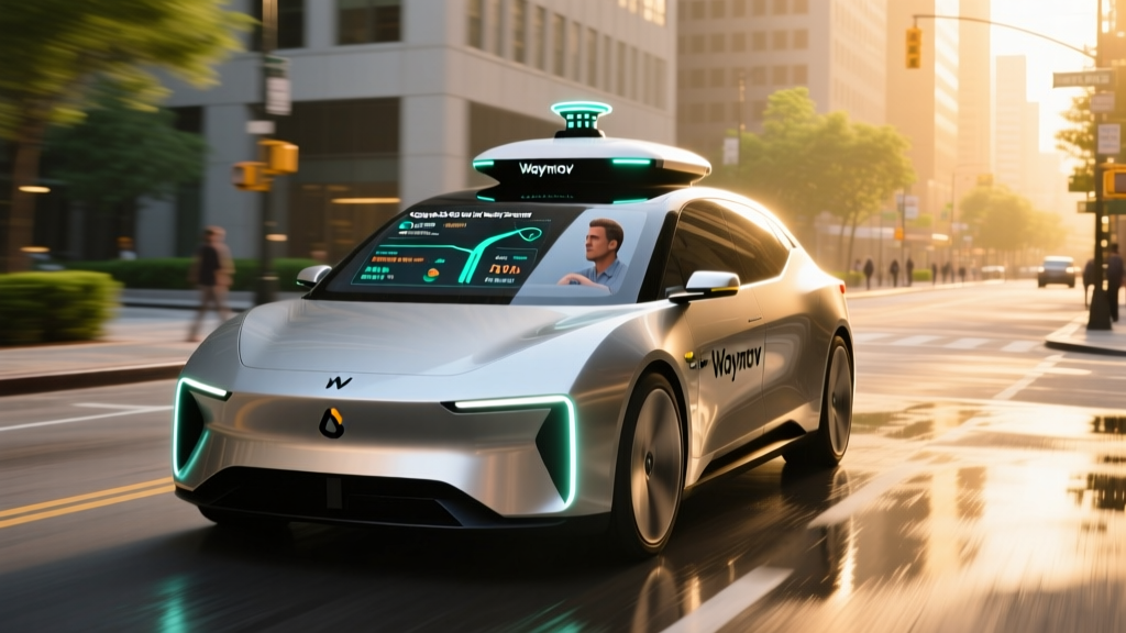
When people search for the Google self-driving car accident rate, they are almost always looking for data on Waymo — the Alphabet subsidiary that evolved from Google's Self-Driving Car Project, launched in 2009 and spun off as an independent company in 2016. Waymo operates the largest fleet of fully driverless robotaxis in the United States, and because it is the most visible name in autonomous ride-hailing, its safety record attracts intense scrutiny.
This guide breaks down what we actually know about Waymo's crash data as of early 2026, how those numbers compare to human-driven baselines, where the service operates, what it costs, and where the technology still falls short. We will also clarify a common source of confusion: the difference between Level 4 robotaxis like Waymo and Level 2 driver-assist systems like Tesla's FSD (Supervised).
First: Waymo Is Level 4, Not Level 2 — Why That Matters
Before examining crash data, it is critical to understand what level of autonomy Waymo operates at. The SAE International J3016 standard defines six levels of driving automation, and conflating them leads to wildly misleading safety comparisons.
| SAE Level | Name | Who Drives? | Example |
|---|---|---|---|
| Level 0 | No Automation | Human does everything | Basic cruise control |
| Level 1 | Driver Assistance | Human + system share one task | Adaptive cruise OR lane-keep |
| Level 2 | Partial Automation | Human supervises; system steers AND accelerates | Tesla Autopilot/FSD Supervised, GM Super Cruise, Ford BlueCruise |
| Level 3 | Conditional Automation | System drives in specific conditions; human must take over when requested | Mercedes Drive Pilot (limited markets) |
| Level 4 | High Automation | System drives fully within its operational design domain; no human needed | Waymo One, Zoox |
| Level 5 | Full Automation | System drives everywhere, all conditions | Does not yet exist commercially |
Waymo operates at SAE Level 4. There is no human driver in the vehicle. The car handles all driving tasks within its geofenced service area, and if the system encounters a situation it cannot handle, it performs a minimal-risk maneuver (pulling over safely) rather than asking a passenger to take the wheel.
This is fundamentally different from Tesla's FSD (Supervised), which is a Level 2 system requiring constant driver attention. When you see headlines about "self-driving crashes," always check whether the vehicle was a Level 4 robotaxi or a Level 2 car with a human who was supposed to be paying attention. The Google self-driving car accident rate refers to Waymo's Level 4 fleet — not consumer vehicles with driver-assist features.
The Google Self-Driving Car Accident Rate: What the Data Shows
Waymo has published multiple safety studies and is required to report collision data to state regulators in California (via the DMV) and Arizona. Here is what the numbers look like based on the most recent public disclosures.
Waymo Safety Data Snapshot (Through Late 2025 / Early 2026)
- Total fully autonomous miles driven: Over 50 million driverless miles (cumulative, across all markets)
- Total miles including testing with safety drivers: Exceeds 75 million autonomous-mode miles
- Reported contact incidents (California DMV data): Approximately 100+ minor incidents logged since driverless operations began, the vast majority being low-speed contact events
- Injury severity: The overwhelming majority of reported incidents involved no injuries or minor injuries; Waymo has reported zero pedestrian fatalities attributed to its driverless fleet
- Most common incident type: Low-speed rear-end or side-swipe contact, often in dense urban traffic or construction zones
How Does This Compare to Human Drivers?
To contextualize the Google self-driving car accident rate, we need a baseline. According to NHTSA FARS data, the U.S. fatal crash rate is approximately 1.35 fatalities per 100 million vehicle miles traveled. The police-reported crash rate (all severities) is roughly 200-300 per 100 million miles, depending on the year and state reporting standards.
Waymo's own peer-reviewed safety study, published in collaboration with Swiss Re, analyzed over 7.1 million driverless miles and found:
- 85% reduction in injury-causing crash rates compared to a human benchmark
- 57% reduction in any-severity crash rates compared to a human benchmark
These figures suggest that within its operational design domain (geofenced urban areas, mapped routes, moderate weather), Waymo's fleet is involved in fewer crashes per mile than the average human driver. However, several caveats apply:
- Sample size: 50 million miles is statistically meaningful but still a fraction of the ~3.2 trillion miles driven annually by U.S. motorists.
- Operational domain: Waymo avoids the most dangerous scenarios — rural highways at 80 mph, heavy snow, unmapped construction zones. Human crash data includes all of these.
- Reporting bias: Waymo vehicles are highly instrumented and report even minor contact events that a human driver might not report (e.g., a bumper tap at 3 mph).
Where Can You Use Waymo Right Now?
Waymo One, the commercial ride-hailing service, is not available everywhere. The fleet operates within geofenced zones in select metro areas. Here is the current service map as of early 2026:
| City / Region | Service Status | Service Area Notes |
|---|---|---|
| Phoenix, AZ (Metro) | Fully operational — open to public | Largest service area: ~315 sq mi covering Phoenix, Scottsdale, Tempe, Chandler, Mesa. Airport service available. |
| San Francisco, CA | Fully operational — open to public | Covers most of SF proper. Highway driving recently enabled on select corridors. SFO airport service launched. |
| Los Angeles, CA | Operational — expanding | Initial zone covers downtown LA, Hollywood, Santa Monica, Westside. Gradually expanding footprint. |
| Austin, TX | Operational — limited public access | Service launched in late 2025 in central Austin corridors. Waitlist-based rollout. |
Waymo has also announced plans for additional cities, but as of this writing, those are in testing or pre-commercial phases and are not yet open to the general public. Always check Waymo's official site for the latest availability.
How Much Does a Waymo Ride Cost vs. Uber and Lyft?
Waymo One is priced to compete with Uber and Lyft, though the exact fare depends on distance, time of day, and demand. Here is a general pricing comparison based on typical rides in Phoenix and San Francisco:
| Factor | Waymo One | Uber / Lyft |
|---|---|---|
| Base fare (short trip, ~3 mi) | $8 – $12 | $9 – $15 (varies by surge) |
| Medium trip (~8 mi) | $15 – $22 | $16 – $28 (varies by surge) |
| Airport trip (SFO ↔ downtown SF, ~14 mi) | $30 – $40 | $35 – $55 (surge dependent) |
| Surge pricing | No dynamic surge (as of early 2026) | Yes — can 1.5x to 3x during peak |
| Tip expected? | No (no driver) | Yes (typically 15-20%) |
| Wait time | 3 – 8 min (varies by zone/demand) | 2 – 10 min |
The key pricing advantage for Waymo is the absence of surge pricing and tipping. During peak hours or bad weather, an Uber ride that would normally cost $18 can spike to $40+. Waymo fares remain stable. On the flip side, Waymo availability can be limited during peak demand — you may face longer wait times rather than higher prices.
To use the service, download the Waymo One app (iOS/Android), enter your destination, and the app will confirm whether your pickup and drop-off are within the service area. Payment is handled in-app via credit card, similar to Uber.
How Waymo's Technology Stack Works
Understanding the Google self-driving car accident rate requires understanding the sensors and software behind it. Waymo's approach is sensor-rich and redundant — fundamentally different from camera-only systems.
Waymo Driver Hardware (6th Generation, deployed on Zeekr RT01 and Jaguar I-PACE vehicles)
- LiDAR: Multiple high-resolution LiDAR units providing a 360° 3D point cloud. LiDAR works in darkness and is not blinded by sun glare — a key advantage over cameras alone. Detection range exceeds 500 meters for large objects.
- Cameras: A surround-camera array (high dynamic range) for object classification, traffic-light state detection, and signage reading. Cameras provide color and texture data that LiDAR alone cannot.
- Radar: Multiple radar units for velocity detection and performance in rain and fog where LiDAR and cameras degrade.
- Audio sensors: External microphones that detect sirens from emergency vehicles and can triangulate their direction.
- HD Maps: Waymo pre-maps every inch of its service area at centimeter-level precision. The vehicle knows the exact position of every lane marking, curb, and traffic signal before it arrives.
- Compute: Custom-built Waymo compute platform running real-time perception, prediction, and planning models. Redundant systems ensure that a single-point failure does not disable the vehicle.
This sensor-fusion approach contrasts sharply with Tesla's camera-only FSD stack. Waymo's reliance on LiDAR and HD maps means it cannot simply deploy anywhere — it must map the area first and ensure sensor coverage works in that specific environment. This is why expansion is measured in years, not months.
Regulatory Landscape: Who Approves Robotaxi Operations?
Robotaxi operations in the U.S. are governed by a patchwork of state and local regulations. There is no single federal "robotaxi license." Here is how the approval process works:
- California (CPUC + DMV): The California Public Utilities Commission (CPUC) issues permits for commercial passenger service. The California DMV separately requires autonomous vehicle testing permits and collision reports. Waymo holds both a DMV testing permit and a CPUC commercial deployment permit.
- Arizona: Arizona has among the most permissive regulatory environments for autonomous vehicles. The state does not require a specific permit for driverless testing or commercial operation, though companies must register and meet insurance requirements. This is why Phoenix was Waymo's first commercial market.
- Texas: Texas passed autonomous vehicle legislation (SB 2807) allowing driverless operations with registration and insurance requirements. Austin operations fall under this framework.
- Federal (NHTSA): The National Highway Traffic Safety Administration sets vehicle safety standards and investigates incidents, but does not currently "approve" or "certify" autonomous driving systems the way it certifies airbags or seatbelts. NHTSA has issued Standing General Orders requiring crash reporting for vehicles with Level 2+ and Level 4+ systems.
The regulatory environment remains in flux. Some cities have imposed restrictions after incidents (San Francisco temporarily capped Waymo fleet size in 2023 before lifting it), while others have actively courted robotaxi deployment. Any change in state law or a high-profile incident can alter the landscape quickly.
Current Limitations: Where Robotaxis Still Struggle
Despite an improving safety record, Level 4 robotaxis like Waymo have well-documented limitations. These constraints directly affect the Google self-driving car accident rate — because Waymo avoids scenarios where it would perform poorly, its data reflects a filtered driving environment.
Known Operational Limitations
- Weather: Heavy rain, snow, fog, and ice degrade LiDAR and camera performance. Waymo limits or suspends service in severe weather. Phoenix's dry climate and SF's moderate conditions are not representative of, say, Chicago in January.
- Geofencing: Waymo vehicles cannot drive outside their pre-mapped zones. If your destination is one mile beyond the geofence boundary, the ride cannot be completed.
- Construction zones: Unexpected lane closures, temporary barriers, and flaggers presenting unusual gestures remain challenging. Waymo has improved here but still occasionally performs conservative stops or reroutes.
- Unprotected left turns: Crossing oncoming traffic at uncontrolled intersections is one of the hardest scenarios for any autonomous system. Waymo handles these but sometimes with longer-than-human hesitation.
- Emergency vehicles: While Waymo detects sirens and pulls over, complex multi-vehicle emergency scenes (fire trucks blocking a lane, police directing traffic) can cause the vehicle to stop and wait rather than navigate around.
- Passenger behavior: No driver means no one to intervene if a passenger becomes ill, acts erratically, or leaves belongings. Waymo has in-cabin cameras and remote support, but these are not equivalent to a human driver's judgment.
- Accessibility: Current Waymo vehicles (Jaguar I-PACE and Zeekr RT01) require passengers to enter and exit independently. Wheelchair-accessible robotaxis remain in development.
These limitations are not secrets — Waymo acknowledges them publicly. They are the reason Level 4 autonomy is not the same as Level 5 (drive anywhere, anytime), and they explain why the safety data must be interpreted within context.
Frequently Asked Questions
Has a Waymo robotaxi ever killed a pedestrian?
As of early 2026, there have been no confirmed pedestrian fatalities caused by a Waymo vehicle operating in fully driverless (Level 4) mode. Waymo's incident reports to the California DMV and Arizona regulators show that the vast majority of contact events are low-speed, low-severity. However, the fleet's total mileage (50+ million driverless miles) is still small compared to the national driving population, so the statistical sample for rare events like fatalities remains limited.
How does Waymo's crash rate compare to Tesla's FSD?
This is an apples-to-oranges comparison. Waymo is Level 4 (no driver present), while Tesla FSD (Supervised) is Level 2 (driver must remain engaged at all times). Tesla publishes quarterly safety data showing crashes per million miles with Autopilot engaged, but these numbers include a human who is legally responsible for the vehicle. Waymo's data reflects a fully autonomous system with no human fallback. Comparing the two directly without noting this distinction is misleading.
Is Waymo safer than a human driver?
Based on Waymo's peer-reviewed study with Swiss Re and its public incident data, the fleet shows a lower crash rate per mile than the human benchmark within its operational design domain. However, this domain excludes the most dangerous driving scenarios (high-speed rural highways, severe weather, unmapped areas). Whether Waymo would maintain this advantage in all driving conditions is not yet proven.
What happens if a Waymo vehicle gets into an accident?
Waymo vehicles are equipped with collision detection and automatic reporting. After any contact event, the vehicle's remote support team is alerted immediately. The vehicle will pull over safely if possible, and Waymo dispatches roadside assistance. Police are contacted for any incident involving injury or significant property damage. All incidents in California are reported to the DMV within 10 days as required by law.
Can I use Waymo if I live outside Phoenix, San Francisco, LA, or Austin?
Not yet, unless you are in a city where Waymo has launched since this article's publication. Waymo's expansion is deliberate — each new city requires extensive mapping, testing with safety drivers, and regulatory approval. Check Waymo's official ride page for the most current service map.
Is Waymo really "self-driving" or is someone watching remotely?
Waymo vehicles drive themselves — there is no remote human steering the car in real time. However, Waymo employs a remote assistance team that can provide high-level guidance (e.g., confirming it is safe to proceed past an unusual obstacle). This is not remote driving; the vehicle still executes all steering, braking, and acceleration decisions autonomously. Think of remote assistance as a human answering a question, not grabbing the wheel.
The Bottom Line on Waymo's Safety Record
The Google self-driving car accident rate, as measured through Waymo's fleet data, suggests that Level 4 robotaxis can achieve crash rates below the human baseline within their operational domain. The Swiss Re study showing an 85% reduction in injury-causing crashes is the most rigorous third-party-validated figure available, and California DMV incident reports corroborate that most events are minor.
But context matters enormously. Waymo's data reflects a fleet operating in mapped, geofenced urban areas with favorable weather and no human driver to make errors — but also no human driver to improvise in novel situations. The sample size, while growing, is still small relative to national driving statistics. And the regulatory environment could shift with a single high-profile incident.
For riders in Phoenix, San Francisco, Los Angeles, or Austin, Waymo One represents a real, available, and competitively priced alternative to Uber and Lyft — one that, by the available evidence, is at least as safe as the average rideshare trip and likely safer. For everyone else, the technology is advancing, the data is accumulating, and the expansion is coming — just not as fast as the headlines sometimes suggest.