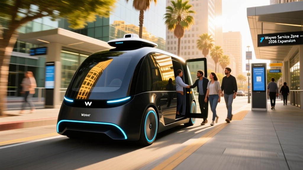
Waymo's driverless taxi service has gone from a limited pilot to a daily transportation option across much of the San Francisco Bay Area. If you've seen the white Jaguar I-PACE SUVs with rooftop lidar pods gliding through SoMa or pulling up to SFO, you've witnessed the most visible robotaxi fleet in the United States. But where exactly can you hail one in 2026, what does it cost, and how does the safety record hold up under scrutiny?
This guide maps the current Waymo One service footprint across the Bay Area, breaks down the technology and regulatory framework that makes it possible, and gives you the concrete numbers you need to decide whether to summon a car with no one behind the wheel.
Is Waymo Actually Self-Driving? The SAE Level Distinction
Before discussing service areas, it's critical to understand what Waymo is — and what it isn't. Consumer systems like Tesla's FSD (Supervised), GM's Super Cruise, and Ford's BlueCruise are SAE Level 2 driver-assistance features. They require a licensed driver in the seat, hands on or near the wheel, and full attention at all times. Waymo One is a fundamentally different category.
| Level | Who Drives | Example | Driver Required? |
|---|---|---|---|
| Level 0 | Human | No automation | Yes |
| Level 1 | Human + system assist | Adaptive cruise control | Yes |
| Level 2 | Human supervises system | Tesla Autopilot, FSD Supervised, BlueCruise | Yes — always |
| Level 3 | System drives in limited conditions | Mercedes Drive Pilot (select markets) | Conditionally |
| Level 4 | System drives fully in geofenced zone | Waymo One, Zoox (limited) | No — no driver present |
| Level 5 | System drives everywhere | Does not yet exist commercially | No |
Waymo operates at SAE Level 4 within its approved geofenced service area. There is no driver, no steering wheel engagement, and no expectation that a passenger will intervene. The vehicle handles all driving tasks — or, if it encounters a scenario it cannot resolve, it executes a "minimal risk condition" (pulling over safely) rather than asking the rider to take over. This is the sharpest line between a robotaxi and every consumer ADAS system on sale today.
Where Can I Use Waymo in the Bay Area Right Now?
Waymo One's Bay Area footprint has grown substantially since the service launched commercially in San Francisco in 2022. As of early 2026, the operational geofence covers the following zones:
| City / Area | Status | Notes |
|---|---|---|
| San Francisco (all neighborhoods) | Live — 24/7 | Full city coverage including Sunset, Richmond, Excelsior |
| Daly City | Live | Coverage extends to Westlake and Serramonte areas |
| South San Francisco | Live | Includes SFO airport pickups and drop-offs |
| San Bruno / Millbrae | Live | SFO corridor coverage |
| Oakland (core areas) | Live — expanding | Downtown, Jack London Square, Rockridge; coverage growing |
| Berkeley | Live | Downtown, UC Berkeley campus area, North Berkeley |
| Mountain View | Live | Waymo HQ city; full coverage |
| Palo Alto / Menlo Park | Live | Stanford area included |
| Sunnyvale / Santa Clara | Live | Full coverage |
| San Jose (select areas) | Live — partial | Downtown, Santana Row, SJC airport; not full city yet |
| Marin County | Not available | Outside current geofence |
| East Bay (beyond Oakland/Berkeley) | Limited | Emeryville, parts of Alameda; Walnut Creek not yet covered |
Key constraint: You must set both your pickup and drop-off within the active geofence. If you request a ride from downtown San Francisco to a destination in Walnut Creek that falls outside the zone, the app will not allow the booking. You can check exact boundaries in the Waymo One app before requesting.
Waymo has also launched SFO airport service, allowing riders to request pickups at designated zones at San Francisco International Airport — a significant expansion for travelers who previously relied on Uber, Lyft, or taxis for airport runs.
How to Ride and What It Costs vs Uber and Lyft
Using Waymo One is straightforward: download the app, enter your destination, and confirm the pickup spot. The vehicle arrives — typically a Jaguar I-PACE equipped with Waymo's 6th-generation Driver sensor suite — and you unlock it through the app. There's no driver to greet you. You buckle up, press "Start Ride" on the rear-seat screen, and the car departs.
Pricing has been one of the most common questions as Waymo has scaled. Here's how it compares to traditional rideshare:
| Route | Waymo One | UberX | Lyft Standard |
|---|---|---|---|
| SF Mission → SFO (~14 mi) | $32–$40 | $28–$45 | $26–$42 |
| Downtown SF → Palo Alto (~33 mi) | $58–$72 | $52–$75 | $50–$70 |
| Oakland Uptown → Berkeley (~5 mi) | $14–$19 | $12–$20 | $11–$18 |
| SF SoMa → Sunset District (~7 mi) | $18–$24 | $15–$25 | $14–$23 |
Waymo's pricing is broadly competitive with UberX and Lyft Standard — sometimes slightly higher during low-demand periods, sometimes lower during surge pricing on rival platforms (Waymo does not currently implement surge multipliers the way Uber and Lyft do). Tipping is not expected since there is no driver. For airport runs, the experience of a guaranteed-quiet, climate-controlled ride with no driver conversation has made Waymo a preferred choice for frequent flyers on the Peninsula corridor.
Wait times in the core San Francisco and Mountain View zones typically range from 3 to 8 minutes. In newer coverage areas like parts of Oakland and San Jose, expect 8 to 15 minutes depending on fleet density and time of day.
How Safe Are Waymo Robotaxis? The Real Data
Safety is the single most scrutinized aspect of robotaxi operations. Waymo publishes periodic safety reports and is subject to incident reporting requirements by the California DMV and NHTSA. Here's what the data shows:
Waymo Safety Record — Key Figures
- Cumulative fully autonomous miles driven: Over 30 million miles (as of early 2026, across all markets including Phoenix, Los Angeles, and the Bay Area).
- Injury-causing crash rate: Waymo's published data shows an approximately 85% reduction in injury-causing crashes per million miles compared to the human driving benchmark in the same geographies, based on internal analysis cross-referenced with police-reported crash data.
- Contact rate with other vehicles/objects: Waymo reports significantly lower rates of contact events per million miles versus human benchmarks in comparable urban environments.
- Notable Bay Area incidents: A small number of low-speed contact events have been reported to NHTSA and the California DMV, as required by regulation. Most involved stationary objects or minor sideswipes in complex construction zones. No fatalities involving Waymo vehicles in autonomous mode have been reported in the Bay Area.
- Recall events: In 2024, Waymo issued a voluntary recall (filed with NHTSA) after a pair of incidents in Phoenix where vehicles made contact with a towed trailer. A software update addressed the edge case — no hardware change was required, illustrating the OTA-update model for robotaxi safety patches.
It's important to contextualize these numbers. Waymo vehicles operate in dense urban environments with high pedestrian, cyclist, and construction-zone complexity — conditions where human crash rates are already elevated. The comparison benchmarks matter. Waymo's internal studies, which have been reviewed by third-party researchers, compare their vehicles' performance to human drivers in the same zip codes and road types, not to national averages that include rural highways.
For comparison, the NHTSA FARS database records approximately 1.35 fatalities per 100 million vehicle miles traveled nationally. Waymo's fleet has not recorded a fatality in autonomous mode across its cumulative miles — though the sample size, while large for a robotaxi fleet, is still small relative to the billions of miles driven by humans annually.
Under the Hood: Waymo's Technology Stack
Unlike Tesla's camera-centric approach to autonomy, Waymo relies on a multi-sensor fusion stack that combines overlapping perception systems for redundancy. The current 6th-generation Waymo Driver, fitted to the Jaguar I-PACE fleet, includes:
Sensor Suite — 6th-Gen Waymo Driver
- Lidar: Multiple roof-mounted and body-integrated lidar units providing 360-degree 3D point-cloud mapping. Lidar operates independently of ambient light, giving the system reliable depth perception at night and in tunnel-like conditions. Range exceeds 200 meters for object detection.
- Cameras: A suite of high-resolution cameras covering 360 degrees, used for lane-line detection, traffic-light state recognition (red/yellow/green/arrow), sign reading, and object classification (pedestrian vs cyclist vs vehicle).
- Radar: Forward and corner radar units for velocity detection of other moving objects, particularly useful in rain and fog where camera performance degrades.
- Audio sensors: External microphones capable of detecting sirens from emergency vehicles, allowing the system to pull over or yield appropriately.
- HD mapping: Waymo pre-maps every road within its geofence at centimeter-level precision. The vehicle localizes itself against this map in real time, combining GPS, IMU (inertial measurement unit), and lidar-matching. This is not a "drive anywhere" system — it operates only where the map exists.
The computational backbone processes sensor data through Waymo's custom perception, prediction, and planning stack. The "prediction" layer is arguably the most sophisticated component: it models the likely future behavior of every detected agent (a pedestrian who might step off a curb, a delivery truck that might double-park) and feeds those predictions into the planning system, which generates the vehicle's trajectory.
This lidar-plus-camera-plus-radar approach contrasts sharply with Tesla's vision-only FSD architecture. The trade-off is cost and complexity — Waymo's sensor suite adds significant per-vehicle expense — versus the redundancy and all-weather reliability that multiple sensor modalities provide.
Who Regulates Waymo, and How Does Approval Work?
Robotaxi operations in California involve overlapping regulatory authority at the state and federal levels:
- California DMV: Issues autonomous vehicle testing permits and deployment permits. Waymo holds a deployment permit that allows driverless commercial operations. The DMV requires annual disengagement reports and incident notifications.
- California Public Utilities Commission (CPUC): Regulates robotaxis as passenger carriers. The CPUC granted Waymo approval to operate commercial, paid driverless rides — the critical permit that separates a "test ride" from a revenue-generating taxi service.
- NHTSA (federal): Sets vehicle safety standards (FMVSS). Because Waymo's Jaguar I-PACE was originally built with a steering wheel and pedals, it meets existing standards without requiring an exemption. NHTSA also collects crash and incident reports through its Standing General Order for automated driving systems.
- Local municipalities: Cities like San Francisco and Oakland have input through their transportation agencies. The SFMTA has worked with Waymo on designated pickup zones, curb management, and integration with public transit corridors.
The regulatory framework remains a patchwork. California has been the most permissive major state for robotaxi deployment, but the CPUC and DMV have also demonstrated willingness to impose restrictions — as seen in 2023 when the DMV temporarily suspended Cruise's (GM's robotaxi subsidiary) permit following a serious incident in San Francisco. That event underscored that regulatory approval is conditional and revocable, not permanent.
Current Limitations: What Waymo Cannot Do
Level 4 autonomy is powerful within its domain, but the boundaries of that domain are firm. Here are the real-world constraints riders encounter:
Waymo One — Known Limitations (2026)
- Geofence boundaries: The vehicle will not drive outside its pre-mapped zone. Trips that cross into unmapped territory (e.g., across the Golden Gate Bridge into Marin, or east past the Oakland Hills into Contra Costa County) are not possible.
- Heavy fog and extreme weather: While Waymo's sensor suite handles rain and nighttime driving well, dense fog — common in the Bay Area, particularly along the coast and near the Bay Bridge — can degrade lidar and camera performance enough to trigger conservative behavior or, in rare cases, service suspension in affected micro-zones.
- Construction zones: Major, unannounced road reconfigurations can challenge the HD map. Waymo's system handles most standard construction-zone lane shifts, but complex multi-stage detours with temporary signals may cause the vehicle to execute a minimal-risk stop and await remote guidance.
- Unprotected left turns in heavy traffic: One of the most challenging maneuvers for any autonomous system. Waymo handles these in most conditions, but in extremely dense, aggressive traffic (e.g., Market Street at 5 PM), the vehicle may take longer to find a gap than a human driver would, leading to perceived hesitation.
- No highway driving (limited): Waymo's Bay Area operations include some freeway segments (e.g., portions of US-101 and I-280 for airport runs), but the system does not handle arbitrary highway routing the way a human driver would. Most trips use surface streets.
- Pets and unaccompanied minors: Waymo's rider policy requires all passengers to be 18 or older (or accompanied by an adult). Pets must be in carriers. These are policy constraints, not technical ones.
- Wheelchair accessibility: The Jaguar I-PACE fleet is not wheelchair-accessible. Waymo has announced plans to integrate accessible vehicles (including the purpose-built Zeekr RT vehicle) into its fleet, but widespread availability in the Bay Area has not yet been confirmed for 2026.
These limitations are not edge cases to dismiss — they define the practical utility of the service. If your commute takes you from Walnut Creek to downtown San Francisco, Waymo cannot currently serve the full trip. If you need to travel during a heavy atmospheric river event with near-zero visibility, expect potential service interruptions.
Waymo vs the Competition: Bay Area Robotaxi Landscape
Waymo is the dominant robotaxi operator in the Bay Area, but it is not the only player:
| Operator | SAE Level | Bay Area Status | Vehicle |
|---|---|---|---|
| Waymo One | Level 4 | Live — wide coverage | Jaguar I-PACE |
| Zoox (Amazon) | Level 4 | Limited testing / early rides | Zoox purpose-built vehicle |
| Cruise (GM) | Level 4 | Suspended — gradual re-entry with safety driver | Chevrolet Bolt EV / Origin (delayed) |
| Aurora | Level 4 | Trucking focus — no Bay Area robotaxi service | Class 8 trucks |
| Tesla (FSD Supervised) | Level 2 | Not a robotaxi — driver required | Model 3/Y/S/X/Cybertruck |
Cruise's suspension in late 2023 following a serious incident in San Francisco — where a pedestrian was struck by a human-driven vehicle and then run over by a Cruise robotaxi that pulled to the curb — reshaped the competitive landscape. Cruise has been slowly re-entering markets with safety drivers behind the wheel, but its driverless commercial service in the Bay Area has not been restored as of early 2026. Waymo has absorbed much of the demand that Cruise once served.
Practical Tips for First-Time Bay Area Waymo Riders
- Download the Waymo One app and create an account before you need a ride. Payment setup takes a minute.
- Check the service area map in the app — boundaries update periodically as Waymo expands.
- Allow extra time on your first ride. The experience of getting into a car with no driver takes adjustment. You'll want a minute to orient yourself.
- Use the in-app support if the vehicle stops unexpectedly. Waymo has remote assistance operators who can help the vehicle resolve a stuck scenario.
- Rate your ride. Feedback loops directly influence route refinement and behavior tuning in specific corridors.
Frequently Asked Questions
Can I hail a Waymo on the street like a taxi?
No. Waymo One is app-based only. You must request a ride through the Waymo One app, which assigns a vehicle and directs it to your specified pickup location. There is no street-hail mechanism.
How much does a Waymo ride cost compared to Uber?
Waymo fares are generally in line with UberX and Lyft Standard pricing in the Bay Area, typically within $2–$5 of a comparable rideshare trip. Waymo does not currently use surge pricing, which can make it cheaper than Uber or Lyft during high-demand periods like weekend evenings or post-event rushes.
What happens if the Waymo vehicle encounters an emergency?
If the vehicle detects a scenario it cannot safely navigate, it executes a "minimal risk condition" — typically pulling to the curb and stopping. A remote assistance operator can then evaluate the situation and, if needed, provide the vehicle with updated routing instructions. Passengers can also contact support through the in-app help button or the rear-seat screen at any time.
Is Waymo safe in the rain?
Yes. Waymo's multi-sensor stack (lidar, radar, cameras) is designed to operate in rain. The system adjusts its driving behavior — increasing following distances, reducing speed — as conditions warrant. Dense fog and extreme downpours are more challenging and may cause localized service adjustments.
Does Waymo operate on freeways in the Bay Area?
Waymo has been approved for and operates on select freeway segments in the Bay Area, including portions of US-101 and I-280, primarily to facilitate airport trips to SFO. However, the majority of trips use surface streets, and the system does not support arbitrary freeway routing across the region.
Can I use Waymo if I have a disability or need wheelchair access?
The current Jaguar I-PACE fleet is not wheelchair-accessible. Waymo has announced partnerships for accessible vehicle integration (including the Zeekr RT), but widespread wheelchair-accessible robotaxi service in the Bay Area is not yet available as of 2026. Riders who can transfer to a standard seat and collapse their wheelchair may be able to use the service, but should contact Waymo support for guidance.
Is Waymo coming to more Bay Area cities?
Yes. Waymo has been steadily expanding its geofence south through the Peninsula and into the South Bay, and east into Oakland and Berkeley. Expansion into additional East Bay cities (Walnut Creek, Concord) and potentially across the Golden Gate into Marin are plausible future additions, but no confirmed timelines have been published. Check the Waymo One app map for the most current boundaries.