Waymo at SFO: What's Actually Available Right Now
Waymo's driverless taxi service has become a fixture of the San Francisco Bay Area, but travelers searching for Waymo at SFO need to understand exactly what's operational, what the pickup experience looks like, and how the service compares to traditional rideshare. As of early 2026, Waymo One operates across a substantial portion of San Francisco and the broader Bay Area, with San Francisco International Airport (SFO) representing one of the highest-demand destinations in the network.
This guide breaks down the real-world experience of catching a Waymo to or from SFO, the technology powering it, verified safety data, and the regulatory framework that governs every trip.
SAE Automation Level: What "Self-Driving" Actually Means Here
Waymo operates at SAE Level 4 (High Automation) within its defined operational design domain (ODD). This means the vehicle handles all driving tasks — steering, braking, navigation, and decision-making — without any human intervention or supervision required, but only within specific geofenced areas and conditions. This is fundamentally different from consumer vehicles equipped with Level 2 systems like Tesla Autopilot, Ford BlueCruise, or GM Super Cruise, which require continuous driver attention and hands-on or eyes-on engagement.
| Level | Name | Driver Role | Example |
|---|---|---|---|
| Level 2 | Partial Automation | Must supervise at all times | Tesla Autopilot, FSD (Supervised), BlueCruise |
| Level 3 | Conditional Automation | Can disengage but must take over on request | Mercedes DRIVE PILOT (limited markets) |
| Level 4 | High Automation | No supervision needed in ODD | Waymo One, Zoox |
| Level 5 | Full Automation | No supervision, any condition | Not commercially available anywhere |
The distinction matters enormously for liability, insurance, and your experience as a rider. In a Waymo, there is no steering wheel accessible to you, no driver to talk to, and no expectation that you monitor the road. The vehicle is fully responsible for the trip.
Service Availability: Where Can You Ride Waymo Right Now?
Waymo One's commercial service footprint has expanded significantly since its Phoenix debut, but it remains geofenced to specific metropolitan areas. As of 2026, here's where you can hail a ride:
| City/Region | Status | Key Coverage Notes |
|---|---|---|
| Phoenix, AZ (Metro) | Fully operational | Chandler, Tempe, Mesa, Scottsdale, Phoenix Sky Harbor Airport |
| San Francisco, CA | Fully operational | Most of SF proper, including SFO airport service |
| Los Angeles, CA | Fully operational | Santa Monica, Hollywood, Downtown LA, Beverly Hills, LAX service expanding |
| Austin, TX | Operational (expanding) | Central Austin and select suburbs |
Waymo at SFO: Airport Pickup Specifics
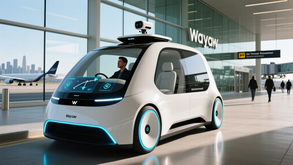
San Francisco International Airport is within Waymo's operational geofence. Riders can request a Waymo for both arrivals and departures. The Waymo One app directs you to designated rideshare pickup zones — the same curbside areas used by Uber and Lyft at SFO. Expect the same airport exit procedures: follow signage for "App-Based Rides" or "Rideshare" after baggage claim.
One practical note: Waymo vehicles are clearly marked Jaguar I-PACE electric SUVs with roof-mounted lidar arrays and Waymo branding. You cannot mistake them for a standard rideshare vehicle. The app provides the vehicle's exact location, license plate, and a photo to help you identify it at the curb.
Pricing: Waymo vs. Uber and Lyft at SFO
Waymo One uses dynamic pricing similar to rideshare platforms, with base fares, per-mile rates, and per-minute rates that fluctuate based on demand. Unlike Uber and Lyft, Waymo does not currently implement aggressive surge multipliers — though wait times can increase during peak demand periods instead.
| Service | Typical Fare Range | Surge Behavior | Tips Required |
|---|---|---|---|
| Waymo One | $30–$45 | Minimal surge; longer waits at peak | Optional (in-app) |
| UberX | $28–$55 | Frequent surge pricing at airport | Optional (15-20% typical) |
| Lyft Standard | $26–$50 | Frequent surge pricing at airport | Optional (15-20% typical) |
On a cost-per-mile basis, Waymo tends to be competitive with UberX and Lyft Standard during normal demand periods and often cheaper during high-surge events at SFO (think post-holiday travel rushes or major conferences). The absence of a human driver also eliminates the social pressure to tip, though the app does offer an optional tip feature.
For shorter intra-city trips — say, from a SoMa hotel to the Mission District — Waymo fares typically run $10–$18, comparable to or slightly below rideshare equivalents.
Safety Record: What the Data Actually Shows
Verified safety metrics (through 2025 reporting periods):
- Total autonomous miles driven: Over 30 million fully driverless miles across all markets (Waymo Safety Report)
- Injury-causing crash rate: Approximately 85% lower than human benchmark rates in comparable urban driving environments, per Waymo's published analysis reviewed by NHTSA
- Police-reportable crash rate: Approximately 57% lower than the human benchmark
- Contactless incidents: Waymo vehicles are involved in contactless reportable incidents (near-misses logged by the system) at rates consistent with conservative defensive driving
Context for the Safety Numbers
Waymo's safety data is among the most transparent in the autonomous vehicle industry, but it requires context. The vehicles operate in geofenced, well-mapped urban areas with relatively low speed limits (typically under 45 mph). They do not currently operate on high-speed highways in most markets, though limited highway-capable testing has occurred in Phoenix.
The comparison benchmark matters: Waymo compares its crash rates to human drivers in the same cities and road types, not to the national average (which includes rural highway driving with different risk profiles). The IIHS has noted that autonomous vehicle safety data remains limited by sample size compared to the billions of miles driven by humans annually.
Notable incidents have occurred — including collisions with stationary objects and rare pedestrian-contact events — and each is reported to the California DMV and NHTSA as required. Waymo publishes detailed responses to high-profile incidents, often including sensor replay data showing the vehicle's perception and decision-making process.
Technology Stack: Sensors, Compute, and the Geofence
Waymo's 6th-generation driver system, deployed across its Jaguar I-PACE fleet, represents one of the most sensor-dense platforms in commercial operation. Unlike Tesla's camera-only approach (which powers its Level 2 FSD Supervised system), Waymo relies on a redundant multi-sensor fusion architecture:
Waymo 6th-Gen Sensor Suite
- Lidar: Multiple roof-mounted and body-integrated lidar units providing 360° 3D point-cloud mapping up to 500+ meters. Lidar is the primary depth-sensing modality and operates independently of lighting conditions.
- Cameras: High-resolution camera array covering 360° with overlapping fields of view for redundancy. Used for object classification, traffic-light state detection, signage reading, and lane-marking identification.
- Radar: Multiple radar units for velocity detection of moving objects, performance in rain and fog where lidar and cameras degrade.
- External audio sensors: Microphones to detect emergency vehicle sirens and adjust behavior accordingly.
- Compute: Custom-designed onboard computing platform processing sensor data in real time with redundant fail-operational architecture — if one compute path fails, a backup takes over immediately.
The geofence is not merely a GPS boundary. Waymo's operational design domain (ODD) includes high-definition maps of every street the vehicles operate on, including lane geometry, traffic signal locations, speed limits, construction-zone patterns, and common pedestrian crossing points. The vehicle cross-references its real-time sensor perception against these maps continuously. If the vehicle detects a discrepancy it cannot resolve — an unmapped road closure, for example — it will execute a safe stop and request remote assistance from Waymo's fleet response team.
Regulatory Framework: Who Approves Waymo's Operations?
Autonomous vehicle operations in the United States are governed by a patchwork of state and federal regulations. For Waymo at SFO specifically, multiple agencies are involved:
- California Public Utilities Commission (CPUC): Grants permits for commercial passenger service (the "TCP" permit equivalent for autonomous vehicles). Waymo holds a CPUC-issued permit for driverless commercial operations in San Francisco.
- California Department of Motor Vehicles (DMV): Issues deployment permits for testing and commercial operation. Requires detailed disengagement reports and collision disclosures.
- National Highway Traffic Safety Administration (NHTSA): Federal oversight of vehicle safety standards. NHTSA has standing general orders requiring all ADS-equipped vehicles to report crashes. Waymo's Jaguar I-PACE fleet must comply with FMVSS standards, with specific exemptions granted for the absence of traditional driver controls.
- San Francisco International Airport (SFO): Airport-specific operating agreements govern pickup/dropoff zones, fees, and operational hours for all rideshare and autonomous services.
California remains the most permissive major state for commercial robotaxi operations, though the regulatory environment is subject to change. In 2023–2024, the CPUC suspended and later reinstated certain operator permits following high-profile incidents, demonstrating that regulatory approval is conditional and revocable.
Current Limitations: What Waymo Cannot Do
Understanding the boundaries of Waymo's service is essential for setting realistic expectations, especially for airport travelers who may encounter edge cases:
- Weather restrictions: Heavy fog (common at SFO and across the Bay Area), torrential rain, or flooding can trigger service suspension in affected zones. Lidar performance degrades in dense particulate conditions, and Waymo will proactively restrict the geofence rather than operate unsafely.
- Geofence boundaries: You cannot request a Waymo to destinations outside the mapped ODD. If your trip from SFO goes to an unmapped suburb, the app will not allow the request. Check the Waymo One app coverage map before booking.
- No highway driving (most markets): In San Francisco, Waymo primarily operates on surface streets. Highway routing via I-280 or US-101 is generally not used, which can increase travel time compared to a human driver who takes the freeway.
- Construction zones and detours: While Waymo handles routine construction with mapped detours, sudden unmarked road closures or complex temporary traffic patterns may cause the vehicle to stop and wait for remote guidance. This can add minutes to your trip.
- Luggage and accessibility: The Jaguar I-PACE has limited cargo space compared to an UberXL or Lyft XL. If you're traveling with multiple large suitcases from SFO, a standard Waymo may be tight. Wheelchair-accessible vehicles are limited in availability.
- No stops mid-trip: You cannot ask the vehicle to pull over at a convenience store or make an unscheduled stop. The route is determined at booking and the vehicle follows it.
- Wait times: During peak hours (early morning and evening rush, post-holiday travel), Waymo availability can be limited. Expect 5–15 minute waits at SFO during peak periods, sometimes longer.
Frequently Asked Questions
Where can I use Waymo at SFO right now?
Waymo One is available for both pickups and drop-offs at San Francisco International Airport. Use the Waymo One app and follow airport signage to the designated rideshare pickup zone. Service operates 24/7 within the geofenced coverage area, though vehicle availability varies by time of day.
How much does Waymo cost compared to Uber or Lyft from SFO?
For a trip from SFO to downtown San Francisco, expect to pay $30–$45 with Waymo, compared to $26–$55 with UberX or Lyft depending on surge conditions. Waymo typically avoids aggressive surge pricing, making it more predictable during peak travel periods. Tipping is optional.
How safe are Waymo robotaxis based on real data?
Waymo reports over 30 million fully driverless miles with injury-causing crash rates approximately 85% lower than human benchmarks in comparable urban environments, per data reviewed by NHTSA. However, sample sizes remain small relative to human driving data, and the vehicles operate in controlled, geofenced, lower-speed urban areas — not highways.
Is Waymo truly self-driving, or is there a remote human driver?
Waymo is a true SAE Level 4 autonomous system. There is no human driver in the vehicle and no remote joystick operator driving the car. A remote fleet response team can provide high-level guidance (e.g., confirming it's safe to proceed past an unusual obstacle), but the vehicle's onboard AI handles all real-time driving decisions independently.
What happens if the Waymo vehicle encounters something it can't handle?
The vehicle is programmed to execute a minimal risk condition — typically a controlled stop in a safe location — and contact Waymo's remote fleet response team for guidance. The vehicle will not proceed through a situation it cannot resolve with high confidence. This can occasionally add a few minutes to your trip.
Can I use Waymo to get from SFO to cities outside San Francisco?
It depends on the destination. Waymo's San Francisco geofence covers most of the city and select surrounding areas. Destinations in the Peninsula, East Bay, or South Bay may fall outside the operational area. Always check the Waymo One app's coverage map before booking — the app will prevent you from requesting a trip to an unsupported destination.
Does Waymo operate at SFO in heavy fog?
Not always. Dense fog — a common condition at SFO, particularly in summer and fall — can degrade lidar and camera performance. Waymo may temporarily restrict service in affected areas during heavy fog events. Check the app for real-time availability; if service is restricted, you'll need to use traditional rideshare or a rental car.