Behind every robotaxi navigating the streets of Phoenix, San Francisco, or Los Angeles is a perception pipeline — the sequence of sensors, algorithms, and decision layers that allow a vehicle to understand its surroundings in real time. If you're an engineer, a technical founder, or simply a deeply curious EV enthusiast trying to understand what separates a Level 4 driverless car from a Level 2 driver-assist system, understanding how to build a perception pipeline for self-driving is the single most important technical foundation you can learn.
This guide breaks down the architecture of a modern autonomous vehicle (AV) perception stack, the sensor choices that define competing approaches, where robotaxis actually operate today, what the safety data shows, and the hard limitations that no amount of neural-network training has fully solved.
What a Perception Pipeline Actually Does
A perception pipeline ingests raw sensor data — camera frames, lidar point clouds, radar returns, ultrasonic echoes — and outputs a structured, real-time model of the world around the vehicle. That model includes:
- Object detection and classification: Identifying vehicles, pedestrians, cyclists, animals, debris, and construction barriers.
- Semantic segmentation: Labeling every pixel or point as road, sidewalk, lane marking, curb, vegetation, or building.
- Depth estimation and 3D reconstruction: Determining how far away every object is and its spatial extent.
- Tracking and prediction: Assigning persistent IDs to moving objects and forecasting their likely trajectories over the next 2–5 seconds.
- Localization: Pinpointing the vehicle's position on a high-definition (HD) map to within 10–20 centimeters.
- Free-space detection: Identifying drivable areas, especially in unstructured environments like parking lots or construction zones.
The output of the perception pipeline feeds directly into the prediction and planning modules, which decide what the vehicle should do next — change lanes, yield, brake, or reroute. If perception fails, everything downstream fails. This is why perception engineers often say the pipeline is responsible for roughly 80% of an AV's safety-critical decisions.
SAE Automation Levels: Where Robotaxis Sit vs. Consumer Cars
Before diving into architecture, it's essential to distinguish between consumer driver-assist systems and true robotaxi autonomy. The SAE International J3016 standard defines six levels of driving automation:
| Level | Name | Who Drives | Examples |
|---|---|---|---|
| 0 | No Automation | Human | Conventional cars |
| 1 | Driver Assistance | Human (system assists steering OR speed) | Adaptive cruise control, lane-keep assist |
| 2 | Partial Automation | Human (must supervise at all times) | Tesla Autopilot, GM Super Cruise, Ford BlueCruise |
| 3 | Conditional Automation | System (in limited ODD), human on standby | Mercedes Drive Pilot (limited highway, <40 mph in select markets) |
| 4 | High Automation | System (within geofenced ODD, no human needed) | Waymo One, Zoox, Baidu Apollo Go |
| 5 | Full Automation | System (everywhere, all conditions) | Does not exist commercially |
Consumer systems like Tesla's FSD (Supervised), GM's Super Cruise, and Ford's BlueCruise are Level 2 — the driver must remain engaged, eyes on or near the road, and legally responsible. Robotaxi services like Waymo One and Zoox operate at Level 4 within defined operational design domains (ODDs) — geofenced areas with mapped routes, specific weather envelopes, and speed limits. No Level 5 system exists today, and none is credibly projected for the near term.
Choosing Your Sensor Stack: Camera-Only vs. Multi-Modal Fusion
The first architectural decision when building a perception pipeline is the sensor suite. There are two dominant philosophies in 2026:
The Camera-Only Approach (Tesla)
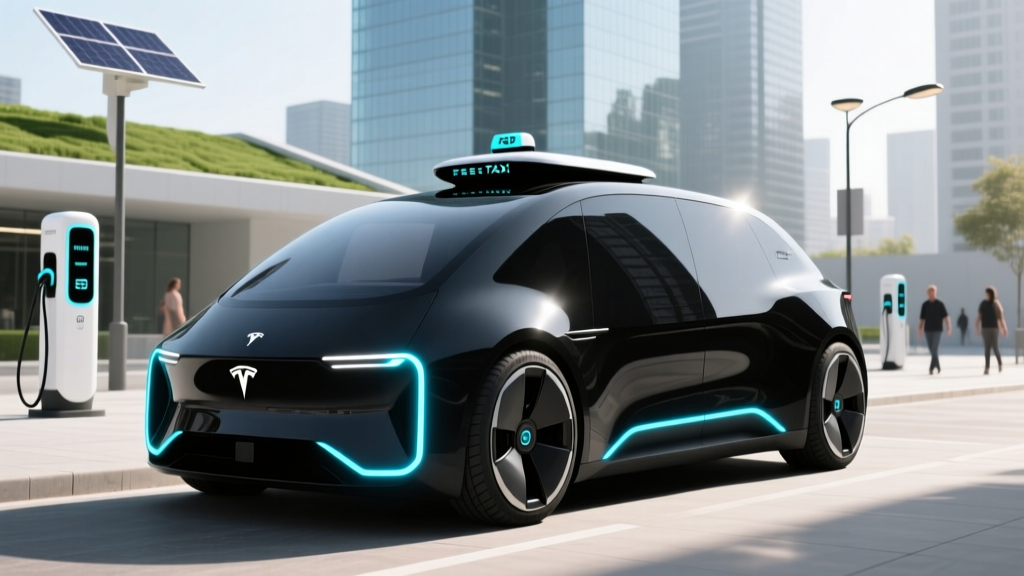
Tesla's FSD stack relies entirely on cameras — typically 8 cameras providing 360° coverage — processed by the onboard HW4 (or newer) neural-network accelerator. Depth is estimated from learned monocular cues and temporal consistency across video frames (a technique sometimes called "pseudo-lidar" or "occupancy network" output). The argument: cameras capture rich semantic information (color, text, traffic-light state), are cheap, and scale to millions of vehicles for data collection.
The trade-off: monocular depth estimation is inherently less reliable at long range and in low-contrast conditions (fog, direct sun glare, darkness without streetlights). Camera-only systems must work harder to achieve the distance accuracy that lidar provides natively.
The Multi-Modal Fusion Approach (Waymo, Zoox, Cruise successors, Baidu)
Level 4 robotaxi operators almost universally use a sensor stack combining:
- Lidar: Typically 360° roof-mounted units plus short-range corner lidars. Modern units (e.g., Waymo's 6th-gen hardware) achieve 200+ meter range, 10–20 Hz refresh, and sub-5 cm ranging accuracy. Lidar provides direct, physics-based depth measurement independent of lighting.
- Cameras: 10–20 cameras covering overlapping fields of view for semantic classification, color-dependent tasks (traffic lights, signs), and redundancy.
- Radar: Imaging radar for velocity measurement (via Doppler), all-weather penetration, and long-range vehicle detection at 300+ meters.
- Ultrasonics: Short-range (0.2–5 m) sensors for low-speed maneuvering and near-field obstacle detection.
- IMU + GNSS + HD Maps: Inertial measurement units, satellite positioning (RTK-corrected), and centimeter-accurate pre-built maps for localization.
The trade-off: higher hardware cost (a full robotaxi sensor suite adds $20,000–$50,000+ to vehicle cost), more complex calibration, higher power draw (often 2–4 kW of compute and sensor power), and more failure modes to manage. But the redundancy and direct depth measurement are considered non-negotiable for driverless operation by every operator except Tesla.
Sensor Stack Comparison
| Attribute | Camera-Only (Tesla) | Multi-Modal (Waymo, Zoox) |
|---|---|---|
| Depth measurement | Learned (neural network estimation) | Direct (lidar time-of-flight) |
| Long-range accuracy (>100 m) | Lower confidence, degrades in low light | High confidence, lighting-independent |
| Weather robustness | Degraded in fog, heavy rain, glare | Lidar/radar partially penetrate; degraded in heavy snow |
| Semantic richness | Excellent (color, text, signals) | Excellent (cameras provide this layer) |
| Hardware cost | Low (~$1,500–$3,000) | High ($20,000–$50,000+) |
| Compute requirement | High (heavy neural inference) | Very high (multi-modal fusion + inference) |
| Deployment scale | Millions of vehicles (data flywheel) | Thousands of robotaxis |
| Safety validation | Supervised (Level 2) | Driverless (Level 4, geofenced) |
Building the Pipeline: From Raw Data to World Model
A production perception pipeline typically follows these stages, running in parallel across multiple compute threads at 10–30 Hz end-to-end:
1. Sensor Preprocessing
Raw camera frames are debayered, white-balanced, and corrected for lens distortion. Lidar point clouds are compensated for ego-motion (the vehicle's own movement during the scan sweep). Radar returns are filtered for noise and clutter. All sensor data is timestamped with hardware-synced clocks (typically PTP or GPS-disciplined oscillators with <1 ms synchronization error).
2. Feature Extraction and Detection
Convolutional neural networks (CNNs) or Vision Transformers (ViTs) process camera images to produce 2D bounding boxes, semantic segmentation masks, and lane-line detections. For lidar, voxel-based or point-based networks (e.g., architectures descended from PointPillars, CenterPoint, or VoxelNet) detect 3D bounding boxes directly in the point cloud.
3. Sensor Fusion
Objects detected independently in camera and lidar are associated — typically using late fusion (combining detection lists after each sensor produces its own output) or early fusion (projecting lidar points into the camera image plane and processing jointly). Radar detections are associated for velocity enrichment. The output is a unified object list with position, size, velocity, heading, and class confidence scores.
4. Multi-Object Tracking (MOT)
Detected objects are assigned persistent track IDs using algorithms like SORT, DeepSORT, or learned association networks. Track state (position, velocity, acceleration) is maintained via Kalman filters or learned dynamics models. Tracks are confirmed, maintained, or pruned based on observation history.
5. Motion Prediction
For each tracked agent (vehicle, pedestrian, cyclist), the system generates a distribution of likely future trajectories over a 2–5 second horizon. Modern approaches use graph neural networks or attention-based models that reason about agent-to-agent and agent-to-map interactions. The output is a set of trajectory samples with associated probabilities.
6. Localization
The vehicle's position is estimated by matching live lidar scans against a pre-built HD map (using ICP or learned registration), fused with RTK-GNSS and IMU dead-reckoning. Target accuracy is 10–20 cm lateral and longitudinal. When GNSS is unavailable (tunnels, urban canyons), the system relies on lidar-to-map matching and IMU integration, which drifts over time and must be re-converged.
Where Robotaxis Actually Operate in 2026
Level 4 robotaxi services are live but geographically constrained. Here is the current operational landscape:
| Operator | Live Cities | Service Hours | Vehicle | Notes |
|---|---|---|---|---|
| Waymo One | Phoenix (metro), San Francisco, Los Angeles, Austin (expanding) | 24/7 in Phoenix/SF; limited hours in newer markets | Jaguar I-PACE (6th-gen sensor suite) | Largest paid rider base; millions of trips completed |
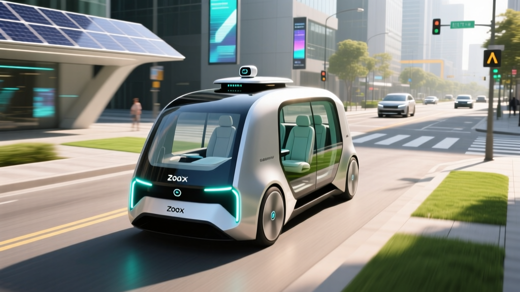
| Zoox | Las Vegas (Strip corridor), Foster City, CA (limited) | Limited hours | Zoox purpose-built vehicle (bidirectional, no steering wheel) | Amazon subsidiary; custom ground-up vehicle |
| Baidu Apollo Go | Wuhan, Beijing, Chongqing, Shenzhen (China) | Extended hours | Various (RT6 latest) | Largest fleet globally by trip volume (China) |
| Cruise | Suspended (post-Oct 2023 incident); limited supervised testing in Phoenix, Dallas | N/A for driverless | Chevrolet Bolt EUV / Origin (paused) | GM subsidiary; phased relaunch under review |
Notice the pattern: every live Level 4 service operates within a geofence — a digitally defined boundary beyond which the vehicle will not enter autonomously. Within that geofence, the HD map is current, the road network has been extensively tested, and the ODD (weather, speed, road type) is well-characterized.
Safety Data: What the Numbers Actually Show
Evaluating robotaxi safety requires comparing intervention rates, crash data, and disengagement metrics against human baselines. The data is imperfect but increasingly available:
- Total autonomous miles driven: Over 50 million fully driverless miles (cumulative across all markets).
- Insurance claim rate: Waymo reported in 2024 that its driverless vehicles had approximately 85% fewer property-damage insurance claims and 90% fewer bodily-injury claims compared to human-driven baselines in comparable geographies (source: Waymo Safety Report).
- Contact rate: Waymo's published data shows a police-reportable contact rate roughly 6x lower than human benchmarks in Phoenix and San Francisco.
- Disengagements: Not directly comparable to California DMV disengagement reports (which mix supervised and unsupervised testing and are self-reported), but Waymo's internal "meaningful intervention" rate has trended downward year-over-year.
Note: Cruise's October 2023 pedestrian-dragging incident in San Francisco — where a human-driven vehicle threw a pedestrian into the path of a Cruise AV, which then stopped but dragged the pedestrian to the curb — led to California DMV permit suspension and a full operational pause. This underscores that edge cases involving multi-agent interactions remain a frontier challenge.
For context, the NHTSA estimates that approximately 94% of crashes involve human error, and the U.S. fatality rate hovers around 1.2–1.3 deaths per 100 million vehicle miles. Robotaxi operators have not yet accumulated enough driverless miles to produce statistically significant fatality comparisons, but the property-damage and injury data trends are directionally favorable.
How to Use a Robotaxi and What It Costs
If you're in a city with live robotaxi service, here's how the experience works and what you'll pay:
Using Waymo One
- Download the Waymo One app (iOS/Android).
- Enter pickup and dropoff locations within the service area.
- The app confirms availability, estimated wait time, and upfront price.
- The vehicle arrives — confirm the license plate and roof markings, then unlock via the app.
- Start the ride from the rear-seat screen. The vehicle drives itself; you can adjust music and climate.
- Upon arrival, exit and the ride charges automatically.
Pricing vs. Rideshare
| Scenario | Waymo One | UberX | Lyft |
|---|---|---|---|
| Short trip (~3 mi, off-peak) | $8–$12 | $9–$14 | $8–$13 |
| Medium trip (~7 mi, off-peak) | $14–$20 | $15–$22 | $14–$21 |
| Surge pricing | Rare (fixed upfront pricing, limited dynamic surge) | Common during peak demand (1.5x–3x) | Common during peak demand |
| Tips | Not expected (no driver) | Expected ($2–$5+) | Expected ($2–$5+) |
Waymo's pricing is generally competitive with UberX and Lyft on a per-ride basis, and often cheaper during surge periods. The absence of a driver tip (typically 15–20% for rideshare) makes the effective cost lower for comparable service. However, Waymo's availability is limited to its geofenced zones, and wait times in fringe areas can exceed 10–15 minutes.
Current Limitations: What Robotaxis Cannot Do
Despite impressive progress, Level 4 robotaxis in 2026 face hard constraints that define where and when they can operate:
- Weather: Heavy rain, snow, fog, and ice degrade lidar and camera performance. Most services suspend or reduce operations in adverse weather. Waymo operates in light rain in Phoenix and San Francisco but pulls back during heavy precipitation.
- Geofence boundaries: The vehicle will not drive outside its mapped service area. If your destination crosses the geofence, the app won't let you book the ride.
- Construction zones: Unexpected lane closures, temporary signage, and altered road geometry can confuse the perception pipeline. Operators often slow or reroute around active construction, but novel configurations remain challenging.
- Unprotected left turns: Crossing oncoming traffic at uncontrolled intersections is one of the most complex maneuvers and a common source of conservative behavior (long waits, aborted turns).
- Emergency vehicles: Detecting and correctly responding to approaching ambulances, fire trucks, and police (pulling over, yielding right-of-way) requires audio and visual processing that is still an active area of refinement.
- Off-map areas: Parking garages, private driveways, dirt roads, and unpaved areas are generally unsupported.
- Edge-case road users: Unusual vehicles (horse-drawn carriages, oversized loads, funeral processions), jaywalking crowds, and erratic human behavior can trigger overly conservative responses or remote-assistance requests.
Regulatory Landscape: Who Approves Robotaxi Operations
Robotaxi deployment in the United States is regulated at both the state and local levels, with no comprehensive federal framework for driverless operations as of 2026:
- California (CPUC + DMV): Operators need a DMV deployment permit (after extensive testing and disengagement reporting) and a California Public Utilities Commission (CPUC) permit for paid passenger service. Cruise's 2023 suspension demonstrated that the DMV can revoke permits on short notice.
- Arizona: Among the most permissive states. Waymo has operated commercially in Phoenix since 2020 under a relatively light-touch regulatory framework. No special state permit is required beyond standard vehicle registration and insurance.
- Texas: Austin has emerged as a testing and deployment market with local coordination but no restrictive state-level permitting regime.
- Nevada: Las Vegas permits limited operations; Zoox has tested and offered limited rides on the Strip corridor.
- Federal (NHTSA): NHTSA has authority over vehicle safety standards (FMVSS) and can investigate crashes or issue recalls. However, NHTSA does not currently "approve" or "certify" AV software for deployment — that authority rests with states. The NHTSA AV safety portal collects voluntary safety self-assessments from developers.
Internationally, China's Ministry of Transport and local municipal governments regulate Baidu Apollo Go and other operators, with city-by-city permits. The EU's regulatory framework for Level 4 deployment is still developing, with pilot programs in Germany and France operating under special exemptions.
Frequently Asked Questions
Is a robotaxi truly self-driving, or is someone watching remotely?
Level 4 robotaxis from Waymo and Zoox are genuinely driverless — there is no human behind the wheel, and the vehicle handles all driving tasks within its ODD. However, operators maintain remote-assistance teams that can be consulted when the vehicle encounters an ambiguous situation (e.g., a construction zone with conflicting signage). The remote agent does not "joystick" the car in real time; instead, they may approve a planned maneuver or provide high-level guidance. The vehicle still executes the driving.
How much does it cost to build a perception pipeline from scratch?
For a research prototype using open-source tools (ROS2, Autoware, CARLA simulator) and commodity sensors, expect $15,000–$50,000 in hardware and months of engineering time. For a production-grade Level 4 pipeline with automotive-qualified sensors, redundant compute, HD mapping, and safety validation, the investment runs into tens of millions of dollars over multiple years with a team of 50–200+ engineers. This is why only well-capitalized companies (Alphabet/Waymo, Amazon/Zoox, GM/Cruise, Baidu) have fielded driverless services.
Can I use Tesla's FSD as a robotaxi?
No. Tesla's FSD (Supervised) is a Level 2 driver-assist system. The driver must remain attentive and is legally responsible for the vehicle at all times. Tesla has discussed a future "Robotaxi" or "Cybercab" concept, but as of 2026, no Tesla vehicle operates as a driverless Level 4 service anywhere. Conflating FSD with Waymo-style robotaxis is a common misconception that leads to dangerous over-trust of consumer driver-assist systems.
What is the biggest unsolved problem in perception for self-driving?
Long-tail edge cases — rare, unusual scenarios that are underrepresented in training data. Examples include a person in a costume, a truck carrying an oversized load that extends beyond its visible body, road debris of novel shapes, or adversarial conditions like sensor-blinding sun angle combined with wet road reflections. These "unknown unknowns" are why Level 4 systems require geofencing and why Level 5 remains distant. The perception pipeline must not only detect known object classes but also recognize that something is anomalous and respond conservatively.
How do robotaxis handle tunnels and GPS-denied environments?
In tunnels or urban canyons where GNSS signals are lost, the vehicle relies on lidar-to-HD-map matching and IMU dead-reckoning for localization. This works well for short durations (a few minutes), but IMU drift accumulates over time. Most geofenced robotaxi routes are designed to minimize extended GPS-denied segments, and HD maps include distinctive structural features (tunnel walls, pillars) that aid lidar localization.
Building a perception pipeline for self-driving is one of the most demanding engineering challenges of the decade. It requires expertise in computer vision, sensor physics, probabilistic state estimation, real-time systems, and safety-critical software engineering. The robotaxis operating today in Phoenix, San Francisco, and a handful of other cities represent billions of dollars of investment and millions of real-world miles — and they still operate within carefully bounded domains. Understanding the pipeline's architecture, its strengths, and its hard limitations is the best way to evaluate where autonomous driving actually stands, separate from the marketing.