The Short Answer: Waymo and Highway Driving in 2026
If you've searched "does Waymo go on the highway" you're likely in a Waymo One service area and wondering whether the robotaxi can take you on a longer freeway trip or if it sticks to city streets. The answer depends on which city you're in and what the current operational design domain (ODD) permits.
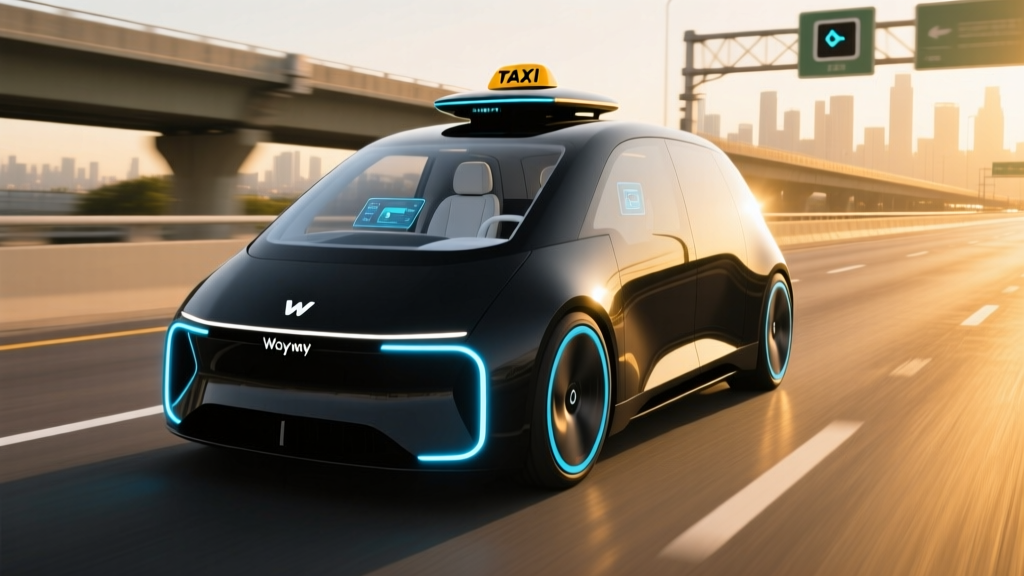
As of early 2026, Waymo One vehicles do operate on select highway segments in specific metro areas — but not universally. In Phoenix and San Francisco, Waymo's sixth-generation Jaguar I-PACE fleet has been navigating mapped freeway corridors for airport runs and cross-city trips since late 2024. In Los Angeles and Austin, highway access remains more limited, with most rides confined to surface streets and major arterials within the geofenced service zone.
SAE Automation Level: What Waymo Actually Is
Waymo One operates at SAE Level 4 — meaning the vehicle handles all driving tasks within its defined operational design domain (geofenced area, approved weather conditions, mapped roads) with no human driver required. There is no one in the driver's seat. This is fundamentally different from Tesla FSD (Supervised), GM Super Cruise, or Ford BlueCruise, which are SAE Level 2 systems that require continuous driver attention and hands-on or eyes-on monitoring. Level 4 robotaxis like Waymo carry full liability for the driving task; Level 2 systems place liability on the human driver at all times.
Where Can You Ride a Waymo Right Now?
Waymo One is not a nationwide service you can summon anywhere. It operates within tightly defined geofences in a handful of U.S. metro areas. Here is the current service footprint as of 2026:
| City | Service Name | Geofence Coverage | Highway Segments | Airport Access |
|---|---|---|---|---|
| Phoenix, AZ | Waymo One | ~315 sq mi (Tempe, Scottsdale, Chandler, Mesa, parts of Phoenix proper) | Yes — Loop 101, Loop 202, I-10 segments | Phoenix Sky Harbor (PHX) |
| San Francisco, CA | Waymo One | ~50 sq mi (most of SF proper) | Yes — select US-101, I-280, I-80 segments | SFO (limited rollout) |
| Los Angeles, CA | Waymo One | ~80 sq mi (Santa Monica, Hollywood, Downtown, Westside) | Limited — surface streets primarily | LAX (announced, not yet live) |
| Austin, TX | Waymo One (limited) | ~45 sq mi (Downtown, South Austin, East Austin) | Surface streets primarily | No |
The Phoenix metro remains Waymo's most expansive service area, and it's where you're most likely to experience genuine highway-speed autonomous driving. The fleet regularly operates at speeds up to 65 mph on mapped freeway segments, handling lane changes, merges, and interchange navigation without remote intervention.
In San Francisco, highway-capable rides were introduced progressively, with Waymo confirming freeway operations on specific corridors connecting neighborhoods like the Sunset District to SoMa or the Presidio to the Mission. Airport service to SFO has been in a phased rollout, initially available to a subset of riders.
How Much Does Waymo Cost vs. Uber and Lyft?
Waymo One uses a pricing model broadly comparable to standard UberX and Lyft rides in the same market — not premium-tier pricing. You request a ride through the Waymo One app, and the fare is calculated based on distance, time, and demand, similar to rideshare dynamic pricing.
| Service | Typical Base Fare | Per-Mile Rate | Per-Minute Rate | Surge Pricing |
|---|---|---|---|---|
| Waymo One | ~$3.00–$4.00 | ~$1.10–$1.50 | ~$0.30–$0.45 | Limited; more stable than rideshare |
| UberX (same markets) | ~$2.50–$3.50 | ~$1.00–$1.40 | ~$0.25–$0.40 | Frequent; can 1.5x–3x during peak |
| Lyft (same markets) | ~$2.50–$3.50 | ~$0.95–$1.35 | ~$0.25–$0.40 | Frequent; similar to Uber |
In practice, a 5-mile ride across central Phoenix typically costs $10–$16 on Waymo One, compared to $8–$14 on UberX without surge. The key difference: Waymo's pricing tends to be more predictable. You won't encounter the 2.5x surge spikes common on Uber and Lyft during rush hour or weekend nights. Waymo has also periodically offered promotional credits for new riders, bringing initial ride costs below traditional rideshare.
Tipping is not expected (there's no driver), though the app does provide an option. Waymo accepts major credit cards and some digital wallets through the app.
How Safe Are Waymo Robotaxis? The Real Data
Safety is the most scrutinized question in autonomous driving, and Waymo publishes more operational data than any other robotaxi operator. Here's what the numbers show:
Waymo Safety Record — Key Data Points
- Cumulative autonomous miles driven: Over 30 million fully driverless miles as of late 2025 (Waymo Safety Data)
- Contact rate: Waymo's internal data and peer-reviewed studies show a roughly 85% reduction in injury-causing crash involvement compared to human benchmarks in comparable urban driving environments
- NHTSA Standing General Order data: Waymo has filed incident reports under NHTSA's mandatory crash-reporting order for Level 4 systems; the majority of reported incidents involve low-speed contact with other road users (e.g., being rear-ended at a stop), not at-fault collisions caused by the AV
- Disengagement model: Waymo does not use "miles per disengagement" as a public safety metric (unlike California DMV reports for Level 2/3 testing), since its Level 4 system is designed to handle all scenarios within its ODD or execute a minimal-risk condition (safe pullover) if uncertain
It's worth noting the context: Waymo vehicles have been involved in minor incidents — like any vehicle fleet operating millions of miles in dense urban environments. Several high-profile incidents in San Francisco (including a 2024 collision involving a Waymo vehicle and a pedestrian in a crosswalk where a human tow-truck driver had positioned the vehicle) prompted scrutiny and NHTSA investigations. Waymo responded with software updates and operational adjustments.
The broader safety case rests on structural advantages: 360-degree sensor coverage with no blind spots, no distraction, no fatigue, no impairment, and reaction times measured in milliseconds rather than the ~1.5 seconds average human response time. Waymo's peer-reviewed research, published in partnership with insurance data analyses, indicates meaningful reductions in crash severity rates within its operational domain.
Under the Hood: Waymo's Technology Stack
Waymo's sixth-generation vehicle platform (integrated into the Jaguar I-PACE and the forthcoming Zeekr RT robotaxi) uses a multi-sensor fusion approach — a fundamentally different philosophy from Tesla's camera-only system.
Sensor Suite — Waymo 6th Generation
- LiDAR: Multiple custom-built laser-scanning units providing high-resolution 3D point clouds up to 500+ meters. LiDAR works in darkness and provides precise distance measurement independent of lighting conditions.
- Cameras: High-dynamic-range cameras covering 360 degrees, used for object classification, traffic-light state detection, signage reading, and lane identification.
- Radar: Imaging radar units for velocity detection of moving objects, performance in rain and fog, and redundancy.
- Audio sensors: External microphones capable of detecting emergency vehicle sirens and directing the vehicle to yield appropriately.
- Compute: Custom Waymo-designed perception and planning hardware mounted in the vehicle, processing sensor data in real time with redundancy across critical systems.
The geofencing model is central to how Waymo achieves Level 4 reliability. Every road within the service area is mapped at centimeter-level precision, including lane geometry, curb positions, traffic signal locations, speed limits, and known construction zones. The vehicle doesn't just "see" the road — it has a prior high-definition map that it cross-references with live sensor data. If the live environment deviates significantly from the map (e.g., an unmapped road closure or a major detour), the system will either reroute or execute a safe stop rather than guess.
This approach trades geographic flexibility for safety certainty. A Waymo vehicle cannot drive in a city it hasn't been mapped and validated for — but within its mapped domain, it has contextual awareness that exceeds what any human driver can maintain.
Current Limitations: Where Waymo Cannot Go
Understanding what Waymo doesn't do is as important as knowing what it does. The Level 4 operational design domain has defined boundaries:
Known Waymo Limitations (2026)
- Geographic boundary: The vehicle will not operate outside its mapped geofence. If you request a ride to a destination beyond the zone, the app will not allow the booking.
- Heavy weather restrictions: Waymo reduces operations or pauses service during heavy rain, dense fog, or flooding. In Phoenix, monsoon-season dust storms can trigger service pauses. In San Francisco, heavy fog may limit availability in certain neighborhoods.
- Unmapped highway segments: Even within a city that has some highway coverage, not every freeway on-ramp or interchange is approved. The vehicle will only enter highway segments that have been validated and mapped for autonomous operation.
- Construction zones: Major roadwork with altered lane configurations can cause the vehicle to reroute or stop. Waymo's operations team updates maps regularly, but fast-changing construction can outpace updates.
- No intercity travel: You cannot take a Waymo from Phoenix to Tucson or from San Francisco to San Jose. These are intra-metro services only.
- Accessibility constraints: While Waymo has been developing features for wheelchair-accessible vehicles and rider assistance, the standard Jaguar I-PACE fleet requires riders to be able to enter and exit the vehicle independently and buckle their own seatbelt.
- No trunk access for riders: The trunk/cargo area is occupied by compute hardware. All luggage must fit in the cabin with you.
The highway question specifically comes down to mapping and validation. Waymo's operations team must certify each highway segment — including merge zones, lane-drop areas, and interchange geometries — before allowing autonomous operation on it. This is why Phoenix has broader freeway access than newer markets: Waymo has been mapping and validating Phoenix highways for years longer than any other city.
Who Regulates Robotaxis? The Approval Framework
Robotaxi operations in the United States are governed by a patchwork of state and federal authorities — there is no single national license to operate.
At the federal level, NHTSA sets vehicle safety standards and investigates incidents. NHTSA's Standing General Order requires all Level 4 operators to report crashes involving their vehicles. However, NHTSA does not currently "approve" or "license" autonomous driving systems the way it certifies vehicles for crash safety.
At the state level, the picture is more specific:
- Arizona: The most permissive regulatory environment. Waymo operates under a state-issued permit with relatively light operational restrictions. The Arizona Governor's Office of Highway Safety and the state's Department of Transportation oversee AV operations.
- California: The most structured regulatory framework. The California Public Utilities Commission (CPUC) issues permits for commercial robotaxi service (passenger-carrying, paid rides). The California DMV issues testing permits and publishes annual disengagement reports. Waymo holds a CPUC "driverless pilot" permit that was expanded to allow 24/7 commercial operations in San Francisco, and subsequently Los Angeles. CPUC AV Program.
- Texas: Austin operations fall under state AV legislation that permits testing and commercial deployment, with local coordination through the city's transportation department.
This patchwork means Waymo's expansion timeline depends heavily on local regulatory approval — not just technical readiness. A city may be technically mappable but unavailable because the state or local government has not issued the required commercial operating permit.
Highway Driving: What the Experience Is Actually Like
For riders who have only experienced Waymo on city streets, the first highway segment can feel surprising. The vehicle accelerates to highway speeds (typically matching the flow of traffic, up to the posted limit of 65 mph), merges onto the freeway via the on-ramp, maintains following distance using its radar and LiDAR, and navigates lane changes with measured, deliberate movements.
Waymo's driving style on highways is often described as cautious and methodical — it won't weave through traffic or make aggressive gap-seeking lane changes. It signals early, checks thoroughly, and executes maneuvers with smooth inputs. This can feel slower than an aggressive human driver during heavy traffic, but it also eliminates the tailgating, sudden braking, and erratic lane changes that cause most highway collisions.
The in-app experience shows a real-time visualization of what the vehicle's sensors are detecting — other cars, trucks, lane markings, and the planned route. On highway segments, you'll see the system tracking vehicles several hundred meters ahead and anticipating merge points well in advance.
Frequently Asked Questions
Does Waymo go on the highway in every city it operates?
No. Highway access varies by market. Phoenix has the most extensive freeway coverage. San Francisco has select highway segments enabled. Los Angeles and Austin are primarily surface-street operations as of early 2026, with highway access expected to expand as mapping and regulatory approvals progress.
Is Waymo truly self-driving, or is someone monitoring remotely?
Waymo is SAE Level 4 — fully autonomous within its operational domain with no driver in the vehicle. There is no remote human "driving" the car via joystick. However, Waymo does have a remote assistance function: if the vehicle encounters an ambiguous scenario (e.g., an unusual construction zone), it can request guidance from a remote operations team. The remote team does not steer or control the vehicle in real time; they provide high-level guidance (e.g., "the lane is open, proceed"), and the vehicle's own systems execute the driving.
Can I take a Waymo to the airport?
In Phoenix, yes — Waymo One serves Phoenix Sky Harbor International Airport (PHX). In San Francisco, SFO service has been rolling out in phases. LAX service in Los Angeles has been announced but is not yet operational. Always check the Waymo One app for your specific pickup/dropoff availability.
What happens if the Waymo vehicle encounters something it can't handle?
The system is designed to enter a "minimal risk condition" — meaning it will safely pull over to the side of the road, activate hazard lights, and contact remote assistance. It will not attempt a maneuver it isn't confident it can execute safely. This is a core design principle of Level 4 systems: when in doubt, stop safely rather than guess.
How does Waymo's safety compare to human drivers?
Waymo's published data and third-party insurance analyses indicate a significantly lower rate of injury-causing crashes per million miles compared to human benchmarks in comparable urban environments — roughly an 85% reduction in their most recent peer-reviewed analysis. However, this comparison applies specifically to the geofenced, mapped, weather-appropriate conditions under which Waymo operates. Human drivers operate in all conditions, including those where Waymo would not. Direct comparisons should account for this operational domain difference.
Will Waymo expand to more cities and highways?
Waymo has publicly stated expansion plans for additional U.S. cities, with announcements expected through 2026–2027. Each new market requires mapping, validation, regulatory approval, and fleet deployment — a process that takes many months per city. Highway segment expansion within existing cities happens incrementally as corridors are mapped and certified. We track expansion updates as they're confirmed; announced cities are not live until Waymo One rides are available to the public.