Why Waymo's Mountain View Hub Matters to Robotaxi Riders
Search for "Waymo office Mountain View" and you'll find the nerve center of the most commercially deployed Level 4 autonomous vehicle fleet in the United States. Waymo's headquarters at 1555 Charleston Road in Mountain View, California, sits in the heart of Silicon Valley — and more importantly, it sits inside one of Waymo's longest-running commercial service zones. The Santa Clara County corridor, including Mountain View, Sunnyvale, and parts of San Jose, has been a live Waymo One operating area since the service expanded beyond its Phoenix origins.
But what does that actually mean for someone who wants to hail a driverless ride today? This guide breaks down exactly how Waymo's robotaxi service works, what the safety data says, what it costs compared to Uber or Lyft, and where the hard limitations still are — all from the perspective of someone who has ridden in and tracked these vehicles for years.
SAE Automation Levels: Where Waymo Sits vs. Consumer Cars
Before anything else, we need to draw a hard line between what Waymo does and what Tesla, GM, or Ford sell to consumers. The confusion here is widespread and consequential.
SAE Automation Level Breakdown
| SAE Level | Name | Who's Responsible | Examples |
|---|---|---|---|
| Level 0 | No Automation | Driver | Legacy vehicles |
| Level 1 | Driver Assistance | Driver | Adaptive cruise control, lane-keeping |
| Level 2 | Partial Automation | Driver (always) | Tesla Autopilot/FSD Supervised, GM Super Cruise, Ford BlueCruise |
| Level 3 | Conditional Automation | System (in narrow conditions) | Mercedes Drive Pilot (limited markets, <40 mph) |
| Level 4 | High Automation | System (in geofenced ODD) | Waymo One, Zoox (limited) |
| Level 5 | Full Automation | System (everywhere) | Does not exist commercially |
Waymo One is SAE Level 4. The vehicle operates without a human driver, without a steering wheel being monitored, within a defined Operational Design Domain (ODD) — a geofenced area with mapped roads, approved weather conditions, and known infrastructure. If the system encounters a scenario it cannot handle, it performs a Minimal Risk Condition (MRC) maneuver: pulling over safely, not handing control to a passenger.
This is fundamentally different from Tesla's Full Self-Driving (Supervised), which remains a Level 2 system requiring active driver engagement at all times, regardless of what the branding suggests. Consumer Level 2 systems are driver-assist. Waymo Level 4 is driverless — within its operational boundaries.
Where Can You Actually Ride a Waymo Robotaxi Right Now?
Waymo One's service footprint has expanded significantly since its Phoenix debut, but it is not nationwide. Here is the current operational landscape:
| Metro Area | Service Zone Coverage | Status | Notes |
|---|---|---|---|
| Phoenix, AZ | ~225+ sq mi (Chandler, Tempe, Mesa, Scottsdale, Phoenix Sky Harbor Airport) | Live — fully driverless | Largest and longest-running zone; airport rides available |
| San Francisco, CA | ~45+ sq mi (most of SF proper) | Live — fully driverless | Dense urban environment; ongoing expansion |
| Los Angeles, CA | ~80+ sq mi (Santa Monica, Hollywood, Downtown, Mid-City, expanding) | Live — fully driverless | Highway driving added in phases |
| Mountain View / Silicon Valley, CA | Parts of Mountain View, Sunnyvale, Palo Alto | Live — fully driverless | Near Waymo HQ; overlaps with Waymo's testing corridor |
| Austin, TX | Selected zones | Live / Expanding | Partnership-driven rollout |
If you are near the Waymo office in Mountain View, you are inside or adjacent to a live service zone. However, coverage is not a simple radius around the HQ — it follows specific mapped corridors that Waymo has validated for driverless operation. You can check exact availability by entering your pickup address in the Waymo One app.
Geofence Reality Check
Waymo vehicles will not pick up or drop off outside their approved service area. If your destination falls outside the geofence, the app will not let you book the ride. The geofence boundary can be as granular as a single block — one side of a street may be in-zone while the other is not. Expansion happens incrementally, not all at once.
How to Use Waymo One and What It Costs vs. Uber and Lyft
Booking a Waymo One ride is straightforward: download the Waymo One app (iOS/Android), create an account, enter your pickup and drop-off, and request a ride. There is no waitlist in most live markets as of 2026 — the service is open to the public in operational zones.
Pricing Comparison: Waymo One vs. Traditional Rideshare
| Factor | Waymo One | UberX / Lyft |
|---|---|---|
| Base fare (typical 5-mile trip) | $12–$18 | $14–$22 |
| Surge pricing | No surge multipliers; limited dynamic pricing | Frequent surge (1.5x–3x+ during peak) |
| Per-mile rate | Comparable to standard rideshare | Varies by market and demand |
| Tipping | Not expected (no driver) | Customary (15–20%) |
| Wait times | 3–8 minutes (varies by zone density) | 2–10 minutes |
| Vehicle consistency | Jaguar I-PACE (all-electric) or Zeekr RT minivan | Varies widely |
The headline: Waymo One pricing is generally competitive with standard UberX/Lyft fares and frequently cheaper during peak-demand windows because Waymo does not apply traditional surge multipliers. You also eliminate the tipping variable. For a 5-mile trip in Phoenix or San Francisco, expect to pay roughly $12 to $18 — sometimes less during promotional periods.
Waymo has also integrated with Uber's app in select markets, allowing Uber users to request a Waymo vehicle directly. Pricing is transparent before you confirm the ride, identical to the standard rideshare booking flow.
Waymo's Safety Record: What the Real Data Shows
This is where opinion often outpaces evidence. Let's look at what Waymo has published and what third-party analyses have found.
Waymo Safety Data Snapshot
- Total autonomous miles driven: Over 40 million fully driverless miles as of late 2025 (Waymo Safety Report)
- Injury-causing crash rate: Waymo reported an 85% reduction in injury-causing crashes compared to human benchmarks in its operating zones, based on over 7.1 million driverless miles analyzed in a study published with NHTSA-referenced data
- Police-reportable crash rate: 57% lower than human benchmarks in comparable urban environments
- Contact rate with other vehicles/objects: Significantly lower than human drivers in the same geographies
Waymo's safety methodology compares its vehicles' crash rates to human baselines in the same cities and road types — not to national averages that include rural highways. This is important context: urban crash rates are higher than highway rates for everyone, so the comparison must be apples-to-apples.
Known Incidents and Context
Waymo vehicles have been involved in reported incidents, and the company is transparent about them through regulatory filings. Notable patterns include:
- Low-speed contact events: Most reported incidents involve very low-speed (under 10 mph) contact with stationary objects, often in construction zones or areas with temporary traffic control changes that alter the mapped environment.
- School zone incidents (2024, Austin): Two incidents in Austin where Waymo vehicles struck pedestrians near school zones drew scrutiny from NHTSA. Waymo issued software updates to improve detection in these scenarios.
- No passenger fatalities: As of early 2026, there have been no reported fatalities involving a Waymo passenger in driverless operation.
For comparison, the U.S. sees roughly 1.35 traffic fatalities per 100 million vehicle miles traveled nationally (NHTSA FARS data). Waymo's fatality rate in driverless operation is zero over 40+ million miles — but the sample size, while large for robotaxis, is still small relative to the billions of miles humans drive annually.
The Technology Stack: Lidar, Cameras, and Geofenced Mapping
Waymo's approach to autonomy is sensor-heavy and map-dependent — the opposite of Tesla's camera-only, vision-based strategy. Understanding this difference explains both Waymo's capabilities and its constraints.
Waymo Driver Sensor Suite (6th Generation)
- Lidar: Multiple proprietary lidar units providing 360-degree, high-resolution 3D point clouds. Lidar works independently of lighting conditions, giving the system reliable depth perception at night, in glare, and in shadow.
- Cameras: Array of high-resolution cameras for color information, traffic light state detection, signage reading, and object classification.
- Radar: Millimeter-wave radar for velocity detection of moving objects and performance in precipitation where lidar and camera signals degrade.
- HD Maps: Centimeter-precision pre-mapped road geometry for every inch of the service area. The vehicle knows lane widths, curb heights, traffic signal positions, and speed limits before it arrives.
- External audio sensors: Microphones to detect emergency vehicle sirens and adjust behavior accordingly.
Lidar vs. Camera-Only: Why It Matters
Waymo's lidar-first approach provides redundant depth perception that does not depend on ambient light or contrast. A camera-only system (like Tesla's) must infer depth from 2D images — a task that works well in clear conditions but can fail in low light, heavy rain, or when objects have unusual shapes. Lidar directly measures distance. The trade-off is cost (lidar units are expensive, though prices have fallen dramatically) and the need for pre-mapped environments. Waymo cannot simply drive into an unmapped town and operate. Tesla's system can theoretically go anywhere a human can see — but it requires a human to supervise, which is why it remains Level 2.
The Vehicle: Jaguar I-PACE and Zeekr RT
Waymo's current primary fleet vehicle is the Jaguar I-PACE, a battery-electric SUV with a 90 kWh battery pack (EPA range ~234 miles, though Waymo's fleet vehicles charge more frequently and never deplete to low SoC). The I-PACE is fitted with Waymo's 6th-generation sensor suite. More recently, Waymo has begun deploying the Zeekr RT, a purpose-built electric minivan designed with a flat floor and sensor integration from the factory, reducing per-vehicle build complexity.
The Regulatory Landscape: Who Approves Robotaxi Operations?
Robotaxi deployment in the U.S. is governed at the state level, with federal oversight of vehicle safety standards. There is no single national "robotaxi license."
Key Regulatory Bodies
- California Public Utilities Commission (CPUC): Issues permits for commercial passenger service in California. Waymo holds a TCP (Transportation Charter Party) carrier permit allowing paid driverless rides.
- California DMV: Issues autonomous vehicle testing and deployment permits. Waymo holds both testing and commercial deployment permits in California.
- Arizona: Among the most permissive regulatory environments. No specific state permit required for commercial AV operation beyond standard business licensing, which allowed Waymo's Phoenix launch.
- NHTSA (federal): Oversees vehicle safety standards and investigates safety defects. NHTSA can issue recalls for AV software — as it did with Cruise in late 2023 following a serious incident in San Francisco.
- Local municipalities: Cities can influence operations through street access, curb management, and local ordinances, even if the state has granted deployment authority.
The patchwork nature of this regulation means Waymo must negotiate entry into each new metro area individually. Expansion to a new city typically takes 12–24 months of testing, regulatory engagement, and community outreach before commercial service begins.
Current Limitations: Where Robotaxis Still Fall Short
Waymo's Level 4 system is genuinely driverless — but "driverless" does not mean "capable of everything a human driver can do." The limitations are real and they define where and when the service works.
Weather Constraints
- Heavy rain: Waymo vehicles will reduce speed or pause service in heavy precipitation. Lidar returns degrade in dense rain, and the system becomes more conservative.
- Fog: San Francisco fog is a known challenge. Waymo has improved performance here through sensor fusion, but dense fog can still trigger service pauses or restricted zones.
- Snow and ice: Waymo does not currently operate in snowy or icy conditions. Snow-covered roads obscure lane markings and alter road geometry in ways the HD maps cannot account for in real time.
Geofence and Route Limitations
- No highway driving (most zones): Waymo has been adding limited freeway segments (notably in Phoenix and LA), but the majority of rides are on surface streets. Cross-city highway trips that a human Uber driver would take are often not available.
- Construction zones: Temporary lane shifts, flaggers, and cones can confuse the system. Waymo vehicles may reroute or stop in complex construction areas.
- Unmapped areas: If the road has changed significantly since the last HD map update — new detour, newly closed street — the vehicle may pull over and request remote assistance.
Edge Cases and No-Go Scenarios
- Complex multi-point turns: Tight cul-de-sacs or multi-point K-turns can cause the vehicle to stop and request remote guidance.
- Emergency scenarios: Waymo vehicles are programmed to yield to emergency vehicles and pull over. In rare cases, this can result in the vehicle stopping in an inconvenient location.
- Passenger assistance: There is no driver to help with luggage, car seats, wheelchairs, or navigation confusion. The vehicle is autonomous; the passenger experience is self-service.
- Pets and unaccompanied minors: Waymo's terms of service restrict unaccompanied minors and have policies around pets in the vehicle.
Mountain View and Silicon Valley: What Riders Near Waymo HQ Should Know
For those searching "Waymo office Mountain View" because they live or work near the headquarters and want to use the service, here is the practical reality:
- Availability: Waymo One is active in parts of Mountain View, Sunnyvale, and surrounding Silicon Valley cities, but coverage is not contiguous across the entire South Bay. Check the app for your specific origin/destination.
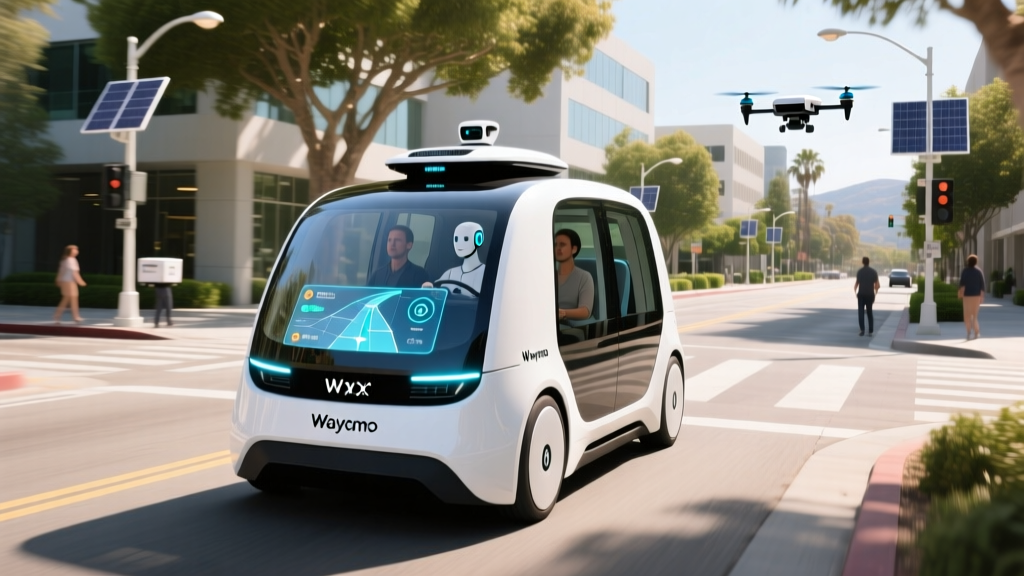
- Vehicle spotting: Jaguar I-PACE vehicles with the distinctive roof-mounted lidar array and side-mounted sensors are common on Charleston Road, Amphitheatre Parkway, and surrounding streets near the Waymo campus. These are a mix of commercial service vehicles and R&D test vehicles.
- Ride experience: Expect a quiet, all-electric ride with no driver interaction. The in-app experience shows your route in real time, and you can contact remote support at any time via the app's help button. The vehicle will not exceed posted speed limits and tends to drive more conservatively than a human rideshare driver.
- Wait times: In the Mountain View/Sunnyvale corridor, typical wait times range from 4–10 minutes, depending on fleet density at the time of request.
Frequently Asked Questions
Is Waymo truly self-driving, or is someone watching remotely?
Waymo vehicles are fully driverless — there is no human in the car, and no remote operator driving the vehicle in real time. Waymo does employ remote assistance (called "fleet response") where a human can provide guidance in ambiguous situations, such as whether it is safe to proceed past a confusing construction zone. However, the remote assistant does not steer or control the vehicle. The autonomous system drives; the human advisor confirms or denies a proposed action. This is SAE Level 4.
How much does a Waymo ride cost compared to Uber or Lyft?
Waymo One pricing is comparable to standard UberX or Lyft fares for equivalent distances. A typical 5-mile ride costs $12–$18. Waymo does not apply surge multipliers during peak demand, which often makes it cheaper than rideshare during busy periods. There is no tipping, since there is no driver. You see the total price before confirming your ride.
How safe are Waymo robotaxis compared to human drivers?
Based on Waymo's published data covering over 40 million driverless miles, the injury-causing crash rate is approximately 85% lower than human benchmarks in comparable urban environments. There have been no passenger fatalities in Waymo's driverless operations. However, the sample size is small relative to total U.S. driving, and the vehicles operate in geofenced, mapped areas — not on arbitrary roads. The data is promising but should be interpreted with the understanding that Waymo avoids the most challenging driving conditions (heavy snow, unmapped roads, highways in most zones).
What happens if the Waymo vehicle encounters a problem during my ride?
If the system encounters a scenario it cannot resolve, it performs a Minimal Risk Condition (MRC) maneuver — typically pulling over to a safe location and stopping. You can contact remote support via the in-app help button at any time. If the vehicle cannot continue, Waymo will arrange an alternative ride or refund. The vehicle will not ask you to take over driving — there are no passenger-accessible driving controls.
Can I use Waymo at airports?
Waymo One serves Phoenix Sky Harbor International Airport (PHX) and has been expanding airport access in other markets. San Francisco International (SFO) and Los Angeles International (LAX) access depends on current regulatory agreements and may require specific pickup/dropoff zones. Check the app for real-time airport availability.
Will Waymo come to my city?
Waymo has announced plans for continued expansion, but new city launches require 12–24 months of mapping, testing, and regulatory approval. Cities on Waymo's announced roadmap are in various stages of pre-commercial testing. No new market is live until the CPUC (in California) or equivalent state body grants commercial deployment authority and Waymo opens the service to the public.