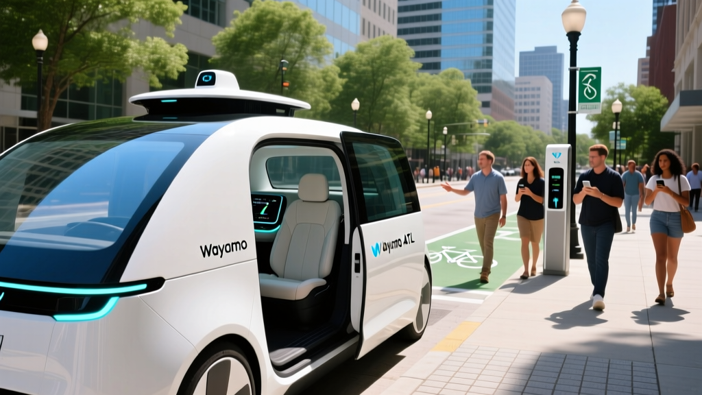
For years, robotaxis were confined to surface streets — crawling through downtown grids at 25–35 mph while human drivers blew past them on the freeway on-ramp. That era is ending. In 2026, Waymo freeways are a growing reality, with the company's sixth-generation autonomous system now operating at highway speeds on select controlled-access roads across several U.S. metros. But the rollout is deliberate, geofenced, and governed by a patchwork of state regulations that determine exactly where you can summon a driverless car and where it simply will not go.
This guide breaks down the current state of Waymo's freeway-capable service: the SAE automation level it operates at, the exact cities and corridors where it runs, what a ride costs compared to Uber or Lyft, the safety data behind millions of driverless miles, the sensor stack that makes it possible, and the limitations that still keep robotaxis off certain roads and out of certain weather.
SAE Level 4 — What "Self-Driving" Actually Means for Waymo
Before mapping routes, it is essential to establish the automation level. Waymo's commercial ride-hailing service, branded Waymo One, operates at SAE Level 4 (High Automation) within its approved Operational Design Domain (ODD). This is fundamentally different from the Level 2 systems consumers buy in personal vehicles.
SAE Automation Levels — Where Waymo Sits
| Level | Name | Who Drives | Example |
|---|---|---|---|
| Level 2 | Partial Automation | Human (must supervise at all times) | Tesla Autopilot, GM Super Cruise, Ford BlueCruise |
| Level 3 | Conditional Automation | System (human must take over on request) | Mercedes Drive Pilot (limited markets, ≤40 mph) |
| Level 4 | High Automation | System (no human needed inside ODD) | Waymo One, Zoox |
| Level 5 | Full Automation | System (all roads, all conditions) | Does not exist commercially |
Source: SAE International J3016
The critical distinction: when a Waymo vehicle encounters a situation outside its ODD — say, a road it has not mapped or a weather condition it cannot handle — it does not hand control to a passenger. It pulls over safely or reroutes. There is no steering wheel for you to grab. This is the opposite of Level 2, where the driver is always the fallback. Waymo's vehicles carry no safety driver during commercial operations; the car is the driver.
Where Can You Use Waymo Freeways Right Now?
Waymo's freeway-capable service is not available everywhere the company operates. Highway driving requires additional mapping, regulatory approval, and system validation beyond surface-street operations. As of early 2026, the following metros have approved freeway segments within the Waymo One geofence:
| Metro | Freeway Status | Key Corridors | Launch Window |
|---|---|---|---|
| Phoenix, AZ | Live — multiple freeways | I-10, Loop 101, Loop 202, portions of I-17 | Freeway ops since 2024; expanded 2025–26 |
| San Francisco, CA | Live — select segments | US-101 (limited), I-280 (portions), Bay Bridge approach | Freeway approval late 2024 |
| Los Angeles, CA | Live — initial corridors | I-10 (downtown to Westside), I-405 (selected segments) | Freeway ops began 2025 |
| Austin, TX | Limited / testing | Surface streets primarily; freeway segments in validation | Commercial launch 2025; freeway TBD |
| Mountain View / Silicon Valley, CA | Live — expanding | US-101, SR-237, portions of I-280 | Part of SF Bay Area expansion |
Important caveat: Even within these metros, the geofence is not a blanket polygon. Waymo approves specific freeway segments, on-ramps, and off-ramps. If you request a ride whose optimal route includes an unmapped interchange, the system will either reroute on surface streets or decline the trip. The app shows the planned route before you confirm, so you know whether the car will take the freeway.
Phoenix remains the most freeway-capable market. The Valley's wide, well-marked controlled-access highways and dry climate made it the natural proving ground. Riders routinely take Waymo on Loop 101 between Scottsdale and Peoria at 65 mph with no human in the front seat. In San Francisco and Los Angeles, freeway segments are more constrained — think of it as freeway-adjacent corridor service rather than full interstate coverage.
The Sensor Stack: How Waymo Sees the Freeway
Waymo's sixth-generation hardware suite, often called the "Waymo Driver Gen 6," is a multi-modal sensor array that differs sharply from the camera-only approach used by Tesla's FSD. Understanding this stack matters for evaluating where the system excels and where it struggles.
Waymo Driver Gen 6 — Key Components
- LiDAR: Multiple roof-mounted and body-integrated units providing a 360° 3D point cloud. LiDAR is range-accurate to ~200+ meters and works identically in darkness and daylight. This is the primary depth-sensing modality for detecting stopped vehicles, debris, and lane boundaries at highway speed.
- Cameras: High-resolution visible-light cameras covering 360° with overlapping fields of view. Used for lane-line detection, traffic-sign reading, signal-light classification, and object recognition (car vs. truck vs. pedestrian).
- Radar: Imaging radar units for velocity measurement of moving objects and performance in rain or fog where LiDAR and cameras degrade. Radar penetrates precipitation that would scatter a laser beam.
- Inertial Measurement Unit (IMU) + GNSS: Sub-meter localization fusing GPS, wheel odometry, and inertial data. The vehicle knows its position on the map to within centimeters — critical for lane-level navigation at 65 mph where a two-meter GPS error could mean merging into a barrier.
- HD Maps: Pre-built, centimeter-accurate 3D maps of every approved road segment. The car does not drive into unmapped territory. Maps include lane geometry, speed limits, merge-lane lengths, and signal phasing.
The LiDAR-versus-camera debate is settled in Waymo's favor for commercial robotaxi use. LiDAR provides deterministic depth measurement that does not rely on neural-network inference from 2D images. At 65 mph on a freeway, the difference between a camera estimating a stopped truck's distance at 150 meters and a LiDAR measuring it at 150 meters is the difference between a comfortable deceleration and a hard emergency brake. Waymo's redundancy across three sensing modalities (LiDAR, camera, radar) is why regulators have approved freeway operations in specific corridors.
The trade-off is cost. A Gen 6 Waymo vehicle's sensor suite is estimated to add $30,000–$50,000 to the base vehicle cost (a Jaguar I-PACE or the newer Zeekr RT purpose-built platform). This is why Waymo operates as a fleet service rather than selling the hardware to consumers. Compare this to Tesla's camera-only FSD hardware, which adds roughly $0 in marginal sensor cost to the vehicle — but operates at Level 2 with the human as the fallback.
Pricing: Waymo One vs. Uber and Lyft
Robotaxi rides are not free, and Waymo One uses dynamic pricing that fluctuates with demand, distance, and time of day — similar to Uber's surge model. Here is how typical fares compare as of early 2026:
| Route (Example) | Waymo One | UberX | Lyft Standard |
|---|---|---|---|
| Short trip — 3 mi, downtown Phoenix | $8–$12 | $9–$14 | $8–$13 |
| Medium trip — 8 mi, SF (SoMa to Marina) | $18–$28 | $16–$25 | $15–$24 |
| Freeway trip — 15 mi, LA (Santa Monica to DTLA via I-10) | $28–$42 | $25–$38 | $24–$36 |
| Airport run — 12 mi, PHX (Sky Harbor to Scottsdale) | $22–$35 | $20–$32 | $19–$30 |
Key takeaway: Waymo fares are broadly competitive with UberX and Lyft Standard — typically within $2–$5 on the same route. Waymo does not currently offer a shared/pool tier, so solo riders pay for the whole vehicle. The value proposition is not cheapness but consistency: no driver rating pressure, no conversation, no detours, and a vehicle that follows traffic law precisely (sometimes to the frustration of tailgaters).
Waymo also offers a subscription-like pricing tier in some markets with discounted per-mile rates for frequent riders, and corporate accounts are available. Tipping is not a feature — there is no driver to tip.
Safety Record: What the Data Actually Shows
Safety is the most scrutinized aspect of robotaxi operations, and Waymo has published more data than any competitor. Here is what the numbers say, with sources.
Waymo Safety Data — Through Late 2025
- Total fully driverless miles: Over 40 million miles (cumulative, across all markets) as of late 2025. Source: Waymo Safety Reports.
- Police-reported crash rate vs. human benchmark: Waymo's fully driverless vehicles showed a ~85% reduction in police-reported crash involvement per million miles compared to the human benchmark in the same geographies, per a study published in partnership with the Insurance Institute for Highway Safety (IIHS) and validated by independent researchers at the Virginia Tech Transportation Institute.
- Injury-causing crashes: Near zero per million miles in driverless mode. The vast majority of incidents involving Waymo vehicles are low-speed property-damage events (e.g., being rear-ended at a stop light by a human driver).
- Disengagement rate: Not directly comparable to other manufacturers because Waymo does not use safety drivers in commercial service. For testing vehicles that do carry operators, remote-assistance interventions average fewer than 1 per 10,000 miles in mature geofences, trending downward as the ODD expands.
- NHTSA Standing General Order data: Waymo has reported incidents as required under NHTSA's Standing General Order for ADS-equipped vehicles. Most reported incidents involve minor contact at low speed with another road user who violated right-of-way.
The safety case for Waymo on freeways specifically is strong in theory — highway driving is more predictable than urban surface streets (no pedestrians, no cross-traffic, consistent lane geometry). But the consequences of any error at 65 mph are far greater. Waymo's approach is incremental: it validates each freeway segment extensively in simulation and with safety drivers before opening it to driverless commercial service. This is why freeway expansion has been slower than surface-street expansion, even though the driving task is arguably simpler.
For context, the U.S. fatality rate on urban interstates is approximately 0.45 per 100 million vehicle miles traveled, per NHTSA data. Waymo has not published a freeway-specific fatality rate because its driverless freeway mileage, while growing rapidly, is still in the millions rather than billions. Zero fatalities have been attributed to Waymo's driverless operations as of this writing.
Regulatory Landscape: Who Approves Waymo Freeways?
Robotaxi operations in the United States are governed at the state level, not federally. There is no single "federal robotaxi license." Instead, Waymo must obtain approval from each state's regulatory body, and often from city-level agencies as well. This creates a patchwork that directly affects where Waymo freeways exist.
In Arizona, the regulatory environment is permissive. The state issued executive orders enabling autonomous vehicle testing and commercial operations with minimal restrictions, which is why Phoenix became Waymo's first market and its most freeway-capable. The Arizona Department of Transportation (ADOT) and the Governor's Office oversee operations, but the bar for approval is comparatively low.
In California, the process is more rigorous. Waymo must hold permits from three agencies simultaneously: the California Department of Motor Vehicles (DMV) for testing and deployment, the California Public Utilities Commission (CPUC) for commercial ride-hailing (TCP permit equivalent), and local city authorities for operational agreements. The CPUC's Phase 3 and Phase 4 deployment permits govern whether Waymo can charge fares and whether it can operate without a safety driver. Freeway approval within California required additional demonstration and was granted incrementally — first for specific segments, then expanded.
In Texas, the regulatory framework is newer. Austin's robotaxi operations are governed by a combination of state legislation (Texas Transportation Code Chapter 547) and city-level agreements. Freeway operations in Austin are still in the validation phase as of early 2026.
At the federal level, NHTSA retains authority over vehicle safety standards (FMVSS). Waymo's vehicles must comply with all applicable standards, though NHTSA has granted limited exemptions for vehicles like the Zeekr RT that lack traditional controls (steering wheel, pedals). The U.S. Department of Transportation has issued voluntary guidance frameworks (AV 1.0 through 4.0) but has not enacted binding federal regulations for Level 4 operations.
Current Limitations: Where Waymo Freeways Cannot Go
Despite the progress, Waymo's freeway service has real limitations that affect daily usability. These are not hypothetical future challenges — they are the boundaries of today's system.
Operational Limitations — Waymo Freeways, 2026
- Geofence boundaries: Only pre-mapped, pre-approved freeway segments are available. You cannot take a Waymo from Phoenix to Tucson on I-10 — the system will not enter unmapped interstate corridors. Trips must begin and end within the approved geofence.
- Weather restrictions: Heavy rain, fog, snow, and ice reduce sensor performance. LiDAR scatters in heavy precipitation; cameras lose contrast in fog. Waymo suspends or restricts service during significant weather events. In Phoenix, monsoon-season dust storms can trigger service pauses. In San Francisco, dense fog on elevated freeway segments (e.g., I-280 through the Daly City corridor) can cause trip rerouting to surface streets.
- Construction zones: Active freeway construction with shifted lanes, temporary barriers, or closed ramps may be outside the ODD. Waymo's HD maps are updated frequently, but a lane shift that appeared overnight may not be mapped yet. The system will reroute around unmapped construction, which can add significant time.
- No airport curbside (most markets): While Waymo serves airport-adjacent areas, direct terminal curbside pickup and drop-off is restricted at many airports due to airport-authority regulations. In Phoenix, Sky Harbor service is available at designated rideshare zones, not at all terminals directly.
- Speed limits: Waymo adheres strictly to posted speed limits, typically operating at or slightly below the limit. On a 65 mph freeway, expect the car to travel at 63–65 mph — not 70–75 mph like surrounding human traffic. This can feel slow and occasionally creates speed-differential situations in the passing lane.
- Edge cases: Emergency vehicles, funeral processions, oversized loads, and unusual road configurations (e.g., collector-distributor roads, reversible express lanes) may fall outside the validated ODD. The system handles most of these, but complex multi-stage merges and diverging HOV lanes require extensive validation before approval.
- No intercity travel: Waymo is a point-to-point urban service, not a long-distance transport option. You cannot book a Waymo for a 200-mile road trip.
The weather limitation is the most impactful for freeway operations. Surface-street Waymo service can often continue in moderate rain because speeds are lower and LiDAR range requirements are shorter. On a freeway at 65 mph, the system needs to detect a stopped vehicle at 150+ meters to brake comfortably. Heavy rain can reduce effective LiDAR range, and if it drops below the safety threshold, the system will exit the freeway or decline the trip entirely.
Is This Truly Self-Driving or Driver-Assist?
This is the most common point of confusion in the autonomous vehicle space, and it deserves a direct answer. Waymo One is truly self-driving within its Operational Design Domain. There is no human driver in the vehicle. There is no steering wheel or pedal set for a passenger to use. The vehicle navigates, merges, changes lanes, handles on-ramps and off-ramps, and responds to traffic conditions entirely on its own.
This is categorically different from Tesla Autopilot, Tesla FSD (Supervised), GM Super Cruise, Ford BlueCruise, and every other consumer system on the market, all of which are SAE Level 2. In those systems, the human driver is legally and operationally responsible for the vehicle at all times. The system assists; you drive. If you fall asleep at the wheel of a Super Cruise-equipped Cadillac on I-5, the car will eventually slow down and stop — but you were supposed to be watching.
In a Waymo vehicle, you are a passenger. You can read your phone, close your eyes, or look out the window. The vehicle is responsible. If something goes wrong, there is a remote-assistance team that can provide high-level guidance (e.g., "proceed around the cone"), but they do not joystick the vehicle in real time. The car makes its own driving decisions at every moment.
The qualifier is the ODD. Waymo is Level 4 — self-driving within its approved domain. It is not Level 5, which would mean self-driving everywhere, in all conditions, on all roads. No Level 5 system exists anywhere in the world as of 2026. When you step outside the geofence, the car simply will not go.
What's Next for Waymo Freeways?
Waymo's expansion roadmap through 2026 and into 2027 focuses on three priorities: expanding freeway coverage within existing markets, adding new cities, and increasing fleet density to reduce wait times. The company has signaled plans to bring freeway-capable service to additional segments of I-405 and I-10 in Los Angeles, more of the Bay Area freeway network, and eventually to new markets where regulatory approval is in progress.
The Zeekr RT vehicle — a purpose-built robotaxi platform designed jointly by Waymo and Geely's Zeekr brand — is expected to become the primary fleet vehicle as older Jaguar I-PACE units are retired. The RT features a lower floor, wider doors, and a sensor suite integrated into the body rather than mounted on the roof, reducing aerodynamic drag and improving efficiency. Its electric powertrain is estimated at a ~100 kWh battery pack with approximately 250–300 miles of real-world range, sufficient for a full day of urban and freeway service before returning to a depot for charging.
The fundamental constraint on Waymo freeway expansion is not technology — it is validation and regulation. Each new freeway segment requires thousands of simulation miles, hundreds of physical test miles, and regulatory sign-off. This is slower than the pace at which consumer Level 2 systems can be updated over-the-air, but it is also why Waymo's safety record is what it is. The deliberate pace is a feature, not a bug.
Frequently Asked Questions
Can I take a Waymo on the freeway in every city where it operates?
No. Freeway operations require separate regulatory approval and geofence mapping. Phoenix has the most extensive freeway coverage. San Francisco, Los Angeles, and Silicon Valley have select freeway segments approved. Austin's freeway operations are still in validation as of early 2026.
How fast does a Waymo drive on the freeway?
Waymo vehicles travel at or slightly below the posted speed limit — typically 63–65 mph on a 65 mph freeway. The system does not exceed speed limits to match the flow of faster traffic. This strict adherence can feel conservative compared to human drivers who commonly travel 5–10 mph over the limit.
What happens if a Waymo encounters an emergency vehicle on the freeway?
The system is trained to detect emergency vehicle lights and sirens and will pull to the right lane or onto the shoulder to yield, consistent with traffic law. This is one of the most extensively validated edge cases in Waymo's simulation environment.
Is Waymo safer than Uber or Lyft on the freeway?
Direct comparison data is limited because Waymo's freeway mileage is still accumulating. However, Waymo's published data shows a significant reduction in police-reported crashes versus the human benchmark across its full operational domain. The primary risk in robotaxi freeway operations is being rear-ended or side-swiped by human drivers, not the robotaxi causing the crash.
Can I use Waymo to get to the airport via the freeway?
In most markets, yes — Waymo can take freeway routes to airport-adjacent rideshare zones. Direct terminal curbside access depends on airport-authority rules. Phoenix Sky Harbor has designated autonomous-vehicle pickup areas. Check the Waymo app for specific airport availability in your city.
Does Waymo work at night on the freeway?
Yes. LiDAR and radar are not dependent on ambient light, and Waymo's cameras use high-dynamic-range sensors for nighttime operation. Night driving is actually one of the conditions where Waymo's sensor advantage over human vision is most pronounced — the system does not experience fatigue, reduced night vision, or glare from oncoming headlights.