Searches for "Waymo child accident" spike periodically after viral dashcam clips or local news reports show Waymo vehicles encountering children near roadways. But what does the actual safety data say? As robotaxis expand across U.S. cities in 2026, separating social-media alarm from documented incident records is critical for riders, parents, and policymakers alike.
This analysis examines Waymo's published safety data, NHTSA incident reports, the technology stack behind its Level 4 autonomy, current operational limitations, and what families should understand before stepping into a driverless vehicle.
What Level of Autonomy Is Waymo — And What That Actually Means
SAE Level 4 — High Automation (Geofenced): Waymo operates at SAE Level 4, meaning the vehicle performs all driving tasks without human intervention within its defined operational design domain (ODD). There is no driver behind the wheel, no steering wheel accessible to passengers, and no expectation that a rider will take control. This is fundamentally different from Level 2 systems like Tesla Autopilot, Ford BlueCruise, or GM Super Cruise, which require continuous driver supervision and are not "self-driving."
| SAE Level | Definition | Example Systems | Driver Required? |
|---|---|---|---|
| Level 2 | Partial automation — steering + acceleration assisted | Tesla Autopilot, FSD (Supervised), BlueCruise, Super Cruise | Yes — full attention |
| Level 3 | Conditional automation — system drives in specific conditions, human must take over when requested | Mercedes Drive Pilot (limited markets) | Yes — on standby |
| Level 4 | High automation — no human driver needed within geofenced ODD | Waymo, Zoox (limited), Cruise (suspended 2023-2024) | No — within ODD |
| Level 5 | Full automation — any road, any condition | Does not exist commercially | No |
Understanding this distinction matters because the "Waymo child accident" search trend sometimes conflates Level 2 incidents (where a human driver failed to supervise) with Level 4 robotaxi performance. These are entirely different engineering and regulatory categories.
Waymo's Safety Record: What the Data Actually Shows
Key safety metrics (through early 2026):
- Cumulative autonomous miles driven: Over 50 million fully driverless miles (Waymo's published figure as of late 2025, with continued accumulation into 2026)
- NHTSA Standing General Order (SGO) reports: Waymo is required to report all crashes involving its ADS-equipped vehicles. These reports are publicly accessible via NHTSA's AV crash database
- Injury severity profile: The vast majority of reported Waymo incidents involve low-speed contact, often with the Waymo vehicle struck by another party — consistent with urban driving exposure
- Waymo's published comparison study: Waymo has released data (peer-reviewed in partnership with insurance and safety researchers) showing reductions in injury-causing crashes per million miles compared to human benchmarks in comparable geographies
The "Child Accident" Context
When a Waymo vehicle encounters a child darting into a roadway — as captured in several widely shared dashcam videos — the system typically initiates hard braking. In some documented cases, the vehicle stopped before contact; in others, minor contact occurred at very low speed. Each incident triggers a mandatory NHTSA SGO report and an internal Waymo safety review.
The heightened concern around children is justified: smaller pedestrians are harder for sensor suites to classify at distance, and children's movement patterns are inherently less predictable than adults'. Waymo's engineering team has publicly discussed the challenge of "small road user" detection as a priority area for continued sensor and perception-stack refinement.
However, no publicly available NHTSA data as of 2026 documents a fatal injury to a child involving a Waymo driverless vehicle. Low-speed pedestrian contacts have occurred — these are serious events that warrant scrutiny — but the severity profile differs substantially from the viral framing.
How Waymo's Safety Compares to Human Drivers
Waymo's safety analysis (published in partnership with researchers and submitted to regulatory bodies) benchmarks its fleet against human driver crash rates in the same cities. The reported findings indicate:
- ~70-85% reduction in injury-causing crashes per million miles vs. human benchmarks in Phoenix and San Francisco
- Near-elimination of certain crash types: rear-end collisions caused by the Waymo vehicle are extremely rare, as the system maintains consistent following distances and 360-degree awareness
- Remaining risk areas: Interactions with erratic human drivers, complex unprotected left turns, and edge-case pedestrian behavior (including children emerging from between parked vehicles)
These figures do not mean robotaxis are "crash-proof." They mean that within the geofenced ODD, the overall crash rate — particularly for severe injuries — is lower than the human average. The child-pedestrian edge case remains one of the harder unsolved scenarios.
Where Can You Ride a Waymo Right Now?
| City | Status (2026) | Service Area Notes |
|---|---|---|
| Phoenix, AZ (Metro) | Fully operational — driverless rides since 2020 | Largest continuous service area; includes airport routes, suburban corridors, and highway segments |
| San Francisco, CA | Fully operational — driverless | Expanded across most of the city; some restrictions during severe weather events |
| Los Angeles, CA | Operational — driverless | Launched 2024; covers core LA corridors, Hollywood, Westside, downtown |
| Austin, TX | Operational — driverless | Expanded service area in 2025-2026; covers downtown, South Austin, airport routes |
| Atlanta, GA | Announced / early operations | Partnership with Uber; limited initial zones, expanding |
Waymo's expansion pace is deliberate: each new city requires geofence mapping, regulatory approval, local emergency-services coordination, and sensor calibration for regional road geometry and weather patterns. This is not a software update — it is a physical-world deployment process that takes months per city.
If you are outside these metros, Waymo is not available to you regardless of demand. The geofence is hard-coded; the vehicle will not operate outside its validated ODD.
How to Use Waymo and What It Costs vs. Uber/Lyft
Riding a Waymo is straightforward: download the Waymo One app (or request through the Uber app in partner cities), enter your destination, and a driverless Jaguar I-PACE (or Waymo's next-generation vehicle) arrives. There is no driver to rate, no conversation, and the in-app experience mirrors a standard rideshare flow.
| Factor | Waymo (Driverless) | Uber/Lyft (Human Driver) |
|---|---|---|
| Base fare structure | Comparable to UberX/Lyft Standard; surge pricing applies during peak demand | Comparable; surge/dynamic pricing applies |
| Typical 5-mile urban ride | $12–$20 depending on city and time | $12–$22 depending on city and time |
| Wait time | 3–8 minutes in dense service zones | 2–10 minutes depending on driver supply |
| Tipping | Not applicable — no driver | Expected ($2–$5 typical) |
| Route predictability | Highly consistent; system optimizes for safety over speed | Varies by driver; may take faster or preferred routes |
| Accessibility options | WAV (wheelchair-accessible) vehicles available in some markets; limited fleet | WAV option available; limited supply in most cities |
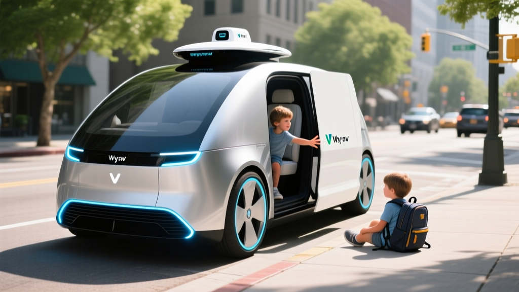
For families specifically: Waymo allows riders to note that minors are in the party, but unaccompanied minors cannot ride alone. An adult (18+) must be present. Car seats are not provided; riders must bring their own if required by state law for the child's age and size.
The Technology Stack: How Waymo Sees the Road
Waymo's perception system is sensor-fused — meaning it does not rely on a single technology but combines multiple overlapping systems for redundancy:
- LiDAR (Light Detection and Ranging): Multiple roof-mounted and body-integrated LiDAR units create a real-time 3D point cloud of the vehicle's surroundings. LiDAR operates independently of lighting conditions — it works equally well at night, in tunnels, and in direct glare. This is a key advantage for detecting small road users (children, cyclists) that a camera-only system might miss in poor lighting.
- Cameras: A suite of high-resolution cameras provides color, texture, and signage/traffic-light recognition. Cameras complement LiDAR by identifying object types (e.g., distinguishing a child from a mailbox at similar distance).
- Radar: Millimeter-wave radar provides velocity data on moving objects and operates reliably in rain and fog where LiDAR and cameras can degrade.
- HD Maps + Geofencing: Waymo vehicles operate only on pre-mapped roads. The system knows the exact location of every lane, crosswalk, curb, and signal before the vehicle arrives. This is not "real-time exploration" — it is navigation within a known environment with real-time obstacle response.
This multi-sensor approach is fundamentally different from Tesla's camera-only FSD (Supervised) system. The engineering trade-off: Waymo's stack is more expensive per vehicle (tens of thousands of dollars in sensor hardware) but provides higher confidence in object detection, particularly for small or partially occluded pedestrians — directly relevant to child-safety scenarios.
The trade-off of the geofenced approach is flexibility: Waymo cannot simply drive into an unmapped neighborhood. Every road in the service area must be surveyed, mapped, and validated before the system is permitted to operate there.
Current Limitations: What Waymo Cannot Do
- Heavy rain and flooding: LiDAR performance degrades in heavy precipitation. Waymo may pause service or restrict routing during monsoon conditions (common in Phoenix during summer months) or heavy Bay Area rain.
- Dense fog: Similar LiDAR and camera degradation. Service may be suspended in low-visibility conditions that a cautious human driver could navigate at very low speed.
- Construction zones: While the system handles many temporary lane shifts, complex or rapidly changing construction zones may cause the vehicle to pull over and request remote assistance or reroute.
- Unmapped roads: The vehicle will not enter a road outside its geofence. Period. If your destination is one block outside the ODD, the ride cannot be completed as requested.
- Emergency vehicles: Waymo is programmed to pull over for emergency vehicles, but there have been documented instances of delayed or awkward responses to complex emergency-vehicle scenarios. NHTSA has scrutinized this.
- Off-road / unpaved roads: Not supported. The system requires paved, marked, mapped roadways.
- Extreme heat events: Sensor thermal management in Phoenix's 115°F+ summer days has required engineering iterations; the current-generation hardware is rated for these conditions but performance margins narrow.
For parents evaluating Waymo for family rides: the system is conservative by design. It will stop rather than risk an uncertain maneuver. This conservatism is a safety feature, but it can result in unexpectedly long travel times or mid-route stops that feel unusual to riders accustomed to assertive human drivers.
The Regulatory Landscape: Who Approves Robotaxi Operations?
Robotaxi deployment in the United States is regulated at both the federal and state levels, with significant variation by jurisdiction:
- Federal (NHTSA): Sets vehicle safety standards (FMVSS) and requires crash reporting via the Standing General Order. NHTSA does not "approve" autonomous driving software but can investigate and compel recalls if safety defects are identified. NHTSA AV Safety Resources
- State DMVs and Public Utilities Commissions: California's DMV Autonomous Vehicle Program issues deployment permits. Arizona has a more permissive regulatory framework. Texas passed enabling legislation in 2023-2024. Each state sets its own rules for testing, commercial deployment, and incident reporting.
- Local municipalities: Cities often negotiate directly with robotaxi operators on service-area boundaries, curb-access rules, and emergency-response protocols.
When an incident like a child-pedestrian encounter generates public concern, multiple regulatory bodies may investigate simultaneously: NHTSA at the federal level, the state DMV or PUC, and local law enforcement. This layered oversight is more rigorous than the post-crash process for human drivers, where investigation typically involves only local police and insurance companies.
Frequently Asked Questions
Has a Waymo vehicle ever hit a child?
NHTSA's Standing General Order crash database includes reports of Waymo vehicles involved in incidents near child pedestrians. In documented cases, these have generally been low-speed events where the vehicle's braking system engaged but could not fully avoid contact. No publicly reported NHTSA data as of 2026 confirms a child fatality involving a Waymo driverless vehicle. Each incident triggers regulatory review and, where warranted, a software update to the perception and planning stack.
Is Waymo safer than a human driver?
Waymo's published data — benchmarked against human crash rates in the same cities — indicates a lower rate of injury-causing crashes per million miles within its operational domain. However, this comparison applies to the geofenced, mapped, urban environments where Waymo operates. The system has not been validated on rural highways, unmapped roads, or in severe weather. "Safer" is context-dependent: within its ODD, the data supports the claim. Outside it, the system does not operate.
Can my child ride alone in a Waymo?
No. Waymo's terms of service require an adult (18 or older) to be present for every ride. Unaccompanied minors are not permitted. If you are riding with a child who requires a car seat under state law, you must provide and install your own — Waymo vehicles do not supply child restraints.
How does Waymo detect children near the road?
Waymo's sensor suite (LiDAR, cameras, radar) continuously scans 360 degrees. The perception system classifies objects by type and size, including pedestrians of varying heights. However, children emerging suddenly from between parked vehicles or other occlusions represent a recognized edge case — the system's reaction time depends on the moment of first sensor detection, which may be very late in these scenarios. This is an active area of engineering focus.
What happens if a Waymo encounters an unexpected situation?
The system is designed to bring the vehicle to a controlled stop and, if necessary, request remote guidance from Waymo's operations team. The vehicle will not attempt a maneuver it cannot confidently execute. This "fail-safe" behavior can result in the vehicle stopping in a travel lane, which has drawn criticism from other road users but prioritizes occupant and pedestrian safety over traffic flow.
How does Waymo's safety compare to Tesla FSD?
This is an apples-to-oranges comparison. Waymo operates at SAE Level 4 (no driver, geofenced), while Tesla FSD (Supervised) is SAE Level 2 (driver must remain fully attentive). Tesla's FSD crash data is confounded by the requirement for human supervision — many FSD-involved crashes occur when the human driver fails to intervene. Waymo's data reflects fully autonomous performance with no human fallback. Direct statistical comparison is not methodologically sound without controlling for these fundamental differences.
The Bottom Line for Families
The "Waymo child accident" search trend reflects a legitimate public concern: how do driverless vehicles handle the most vulnerable and unpredictable road users? The honest answer is that child-pedestrian detection remains one of the harder challenges in autonomous driving, and no system — Waymo included — has solved it perfectly.
What the data does show is that Waymo's multi-sensor Level 4 system, operating within its validated geofence, produces a lower overall injury-crash rate than the human average in comparable urban environments. The system's conservatism — hard braking, controlled stops, refusal to attempt uncertain maneuvers — is a deliberate safety philosophy, not a limitation of capability.
For families considering Waymo: the vehicle will not drive recklessly, will not be distracted, and will brake harder and faster than most human drivers when a child enters the roadway. But it also cannot match a vigilant human driver's ability to anticipate context — a school zone at dismissal time, an ice cream truck on a summer street, a ball rolling into the road suggesting a child may follow.
Ride with your children, observe how the system behaves, and make your own assessment. The data supports cautious confidence; the edge cases demand continued scrutiny.