What the Waymo Austin Map Actually Covers in 2026
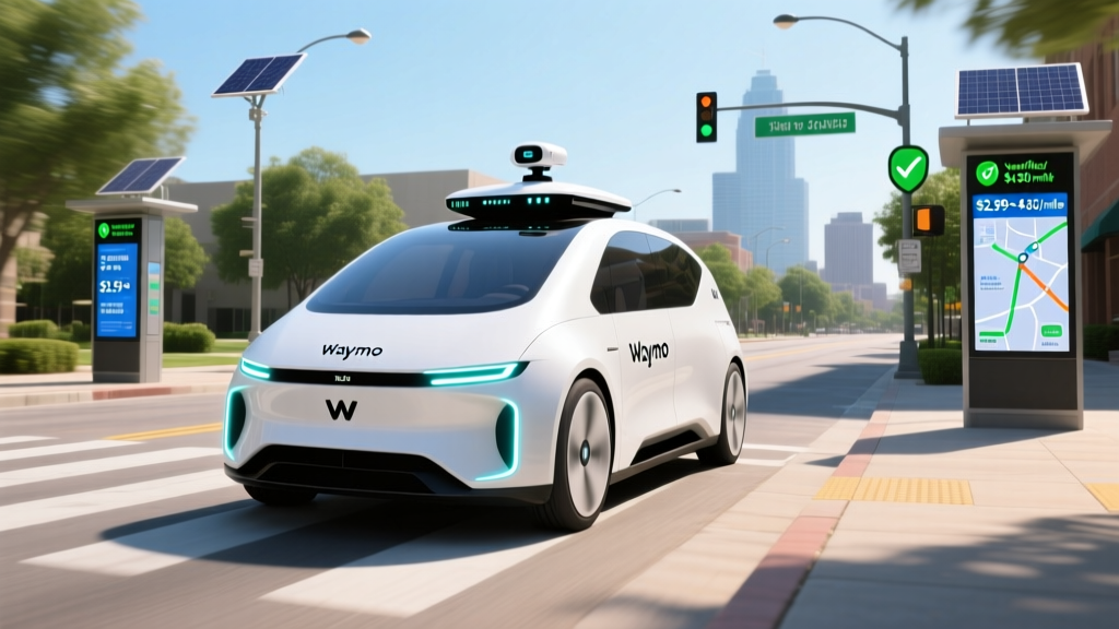
If you have searched for the Waymo Austin map hoping to hail a driverless ride across the entire city, the reality is more nuanced. Waymo One, the company's commercial robotaxi service, operates within a defined geofenced zone in Austin, Texas — not citywide. As of early 2026, the service area spans roughly 40+ square miles covering downtown Austin, the Capitol Complex, South Congress, East Austin, parts of the Domain in North Austin, and the corridor toward Austin-Bergstrom International Airport (AUS).
This geofence is not arbitrary. Waymo restricts its Level 4 driverless operations to areas it has exhaustively mapped and validated, including lane-level HD maps, traffic signal integration, and edge-case testing. If your pickup or drop-off falls outside the polygon, the Waymo One app will simply not let you book the ride.
Waymo One in Austin operates at SAE Level 4 — meaning the vehicle handles all driving tasks within its Operational Design Domain (ODD) with no human driver behind the wheel. This is fundamentally different from consumer systems like Tesla FSD (Supervised), GM Super Cruise, or Ford BlueCruise, which are SAE Level 2 and require an attentive driver ready to take over at any moment. In a Waymo robotaxi, there is no steering wheel for you to grab — the car is the driver.
Where Can I Use Waymo One in Austin Right Now?
Waymo's Austin service area has expanded incrementally since the company began commercial operations in the city. Here is a breakdown of the key zones currently included in the Waymo Austin map:
| Zone | Coverage Notes |
|---|---|
| Downtown / Capitol Complex | Core coverage, high availability |
| South Congress (SoCo) | Full coverage including retail corridor |
| East Austin | Coverage extends east to ~Pleasant Valley Rd |
| The Domain (North Austin) | Retail/residential hub, connected via Mopac corridor |
| Austin-Bergstrom Airport (AUS) | Airport pickups/drop-offs available at designated zones |
| South Lamar (SoLa) | Partial coverage, expanding |
| Westlake / Rollingwood | Limited — hilly terrain and winding roads restrict ODD |
To check whether a specific address falls within the Waymo Austin map boundary, open the Waymo One app, enter your destination, and the app will confirm availability. There is no public interactive map showing the exact geofence polygon — the app itself is the authoritative source.
How to Ride and What It Costs vs. Uber and Lyft
Booking a Waymo One ride in Austin works much like any rideshare app:
- Download the Waymo One app (iOS or Android)
- Create an account with a payment method
- Enter your pickup and drop-off (both must be inside the geofence)
- Confirm the ride — a Jaguar I-PACE or the newer Zeekr RT vehicle arrives within minutes
- Tap the screen inside the car to start the ride; there is no driver to greet you
Pricing: Waymo One vs. Uber/Lyft in Austin
Waymo prices its rides to be competitive with UberX and Lyft standard fares. Based on rider reports and published pricing in 2026, here is how typical Austin trips compare:
| Route | Distance | Waymo One | UberX | Lyft |
|---|---|---|---|---|
| Downtown → AUS Airport | ~8 mi | $22–$28 | $20–$32 | $19–$30 |
| Capitol → The Domain | ~12 mi | $28–$36 | $25–$38 | $24–$36 |
| SoCo → East Austin | ~3 mi | $10–$14 | $9–$16 | $9–$15 |
Waymo does not use surge pricing in the same dynamic way Uber and Lyft do. During peak demand, wait times increase rather than prices spiking 2x or 3x — a meaningful advantage during events like SXSW or ACL Festival. However, Waymo availability can be limited during those same peaks due to fleet constraints.
Waymo's Safety Record: What the Data Actually Shows
Safety is the single most scrutinized aspect of robotaxi operations. Waymo has accumulated tens of millions of driverless miles across its operational cities (San Francisco, Phoenix, Los Angeles, and Austin), and the data tells a specific story.
- 20+ million fully driverless miles completed across all cities
- ~85% reduction in injury-causing crash rates vs. human benchmark (based on NHTSA-referenced data and Waymo's peer-reviewed insurance-claims study)
- Contact rate (any physical contact with another object): significantly lower than human drivers per million miles, per Waymo's published safety methodology
- Austin-specific incidents: minor low-speed events reported; no fatalities attributed to Waymo driverless operations in Austin as of early 2026
Sources: NHTSA Standing General Order for ADS crash reporting, Waymo Safety Reports, IIHS research on automated vehicle crash outcomes.
The critical context: most robotaxi incidents that make headlines involve low-speed, low-severity contacts — often rear-end events while the Waymo vehicle is stopped or moving cautiously. Waymo vehicles tend to drive more conservatively than humans, which reduces severe crash risk but occasionally causes frustration among human drivers sharing the road.
The Technology Stack: Lidar, Cameras, and HD Maps
Waymo's approach to autonomy is sensor-rich and fundamentally different from camera-only systems like Tesla's vision-based FSD stack. The current Waymo fleet (primarily the 6th-generation hardware on Zeekr RT vehicles and retrofitted Jaguar I-PACE units) carries:
- Lidar: Multiple custom-built lidar units providing 360° high-resolution point clouds, effective at 500+ meters
- Cameras: 29+ cameras covering all directions, optimized for varied lighting including direct sun and night
- Radar: Imaging radar for velocity detection and all-weather object tracking
- External audio sensors: Detect sirens from emergency vehicles before they are visible
- HD Maps: Centimeter-accurate lane-level maps of every street in the ODD, updated continuously
This multi-sensor fusion approach means the vehicle does not rely on any single sensor modality. If heavy rain degrades camera visibility, lidar and radar compensate. If a construction zone changes lane markings, the HD map provides a prior that the perception system cross-references. This is why Waymo's ODD is geofenced — the company needs validated HD maps for every road it operates on.
The trade-off: this hardware stack is expensive (estimated $100,000+ per vehicle in sensor and compute hardware), which is why Waymo operates as a fleet service rather than selling the technology to consumers. By contrast, Tesla's camera-only approach aims for scalability at lower hardware cost but has not achieved Level 4 reliability.
Regulatory Landscape: Who Approves Waymo in Austin?
Robotaxi operations in Texas sit at the intersection of state and local regulation:
- Texas Department of Transportation (TxDOT): Texas passed legislation (HB 3932 and subsequent updates) establishing a framework for autonomous vehicle operation, including requirements for ADS-equipped vehicles to comply with all traffic laws and carry insurance
- NHTSA (Federal): All ADS-equipped vehicles must comply with Federal Motor Vehicle Safety Standards (FMVSS). Waymo's vehicles are production models (Jaguar I-PACE, Zeekr RT) that meet these standards, though NHTSA has granted limited exemptions for purpose-built driverless vehicles (like the Zoox carriage) that lack steering wheels
- City of Austin: Local permits and coordination with Austin Transportation & Public Works for curb management, airport access, and incident response protocols
- NHTSA Standing General Order: Requires all ADS operators to report crashes involving their vehicles — providing the public crash data referenced above
Unlike California, where the CPUC and DMV jointly regulate robotaxi permits with public vote processes (as seen in the San Francisco expansion debates), Texas has taken a comparatively streamlined approach, which partly explains why Austin became a priority expansion city for Waymo.
Current Limitations: Where Waymo Cannot Go (and Why)
- No service outside the geofence: Suburbs like Round Rock, Cedar Park, Pflugerville, and San Marcos are not covered
- No highway driving at full speed: Waymo vehicles can handle certain limited-access roads within the ODD but avoid high-speed freeway segments in most configurations
- Heavy rain and flooding: While the sensor suite handles moderate rain, severe thunderstorms and flash-flood conditions may trigger service suspension — Austin's spring and fall storm seasons can cause temporary pullbacks
- Construction zones: Major roadwork with lane closures and temporary barriers may not be navigable if the HD map hasn't been updated; the vehicle may reroute or end the trip early
- Unpaved roads and private property: The ODD covers paved public roads only
- No inter-city trips: You cannot take a Waymo from Austin to San Antonio or Houston
These limitations are not bugs — they are deliberate engineering boundaries. Waymo's safety case depends on operating within conditions it has validated. When you see critics argue that robotaxis are "limited," this is the correct framing: they are limited by design, and that limitation is what makes the safety data possible.
Frequently Asked Questions
Is Waymo truly self-driving or is there a remote human operator?
Waymo One operates at SAE Level 4 — there is no human driver in the vehicle and no remote joystick operator driving the car in real time. Waymo does have remote assistance agents who can provide high-level guidance (e.g., confirming it is safe to proceed past an unusual obstruction), but these agents do not steer or control the vehicle. The onboard AI makes all real-time driving decisions.
How much does a Waymo ride cost compared to Uber or Lyft?
Waymo One pricing in Austin is generally comparable to UberX and Lyft standard fares for the same route — typically within $2–$5 of a standard rideshare. The key difference is that Waymo does not apply aggressive surge multipliers, so during peak events your Waymo fare may be significantly cheaper than a 2x-surged Uber.
How safe are Waymo robotaxis based on real data?
Across 20+ million driverless miles, Waymo's published data shows an approximately 85% reduction in injury-causing crash rates compared to the human driving benchmark. NHTSA's Standing General Order crash data is publicly available and provides an independent reporting mechanism. No fatalities have been attributed to Waymo's driverless operations.
Can I use Waymo to get to the Austin airport?
Yes. Austin-Bergstrom International Airport (AUS) is within the Waymo Austin service area, with designated pickup and drop-off zones. Expect fares in the $22–$28 range from downtown.
What happens if the Waymo vehicle encounters a situation it cannot handle?
The vehicle will come to a safe stop, pull over if possible, and contact Waymo's remote assistance team. If the situation cannot be resolved, the ride may end early and you will be credited accordingly. The vehicle will not attempt maneuvers outside its validated capabilities.
Is the Waymo Austin map going to expand?
Waymo has been incrementally expanding its Austin geofence since launch. Expansion into additional neighborhoods and corridors is expected through 2026, but specific timelines and boundaries are not announced in advance. Check the Waymo One app periodically — the service area updates are reflected in real time.