If you have searched for a robotaxi map hoping to find coast-to-coast coverage, the reality in 2026 will both reassure and frustrate you. Fully driverless commercial ride-hail — what the Society of Automotive Engineers classifies as Level 4 automation — operates in a handful of U.S. metro areas under tightly controlled geofences. It is real, it is bookable, and it is expanding. But it is not yet ubiquitous.
This guide maps where you can summon a steering-wheel-free ride today, what it costs compared to Uber or Lyft, how the technology actually works, and what the safety record shows when you strip away the headlines.
SAE Automation Levels: Why "Self-Driving" Means Different Things
Before plotting any robotaxi map, we need to separate consumer driver-assist from commercial driverless. Tesla's FSD (Supervised), GM's Super Cruise, and Ford's BlueCruise are all SAE Level 2 systems: the human driver must remain engaged, monitor the road, and take over at any moment. Robotaxis from Waymo, Zoox, and the restructured Cruise operation are SAE Level 4: no human driver is present or needed within their approved operational design domain (ODD).
| Level | Name | Who Drives | Example |
|---|---|---|---|
| 0 | No Automation | Human | Legacy cruise control |
| 1 | Driver Assistance | Human (system assists) | Adaptive cruise, lane-keep |
| 2 | Partial Automation | Human (must supervise) | Tesla FSD Supervised, BlueCruise |
| 3 | Conditional Automation | System (human on standby) | Mercedes Drive Pilot (limited markets) |
| 4 | High Automation | System (within ODD) | Waymo One, Zoox |
| 5 | Full Automation | System (all conditions) | Does not yet exist commercially |
The Live Robotaxi Map: Cities Where You Can Book Right Now
As of mid-2026, three operators run commercial, fully driverless (no safety driver behind the wheel) paid robotaxi services in the United States. Here is where each one actually picks up passengers.
| Operator | Vehicle Platform | Live Cities | Service Hours | Geofence Notes |
|---|---|---|---|---|
| Waymo One | Jaguar I-PACE EV, Zeekr RT (rolling out) | Phoenix metro (East Valley, Downtown, Sky Harbor airport), San Francisco (most of city + SFO), Los Angeles (Downtown to Santa Monica corridor), Austin (core + airport) | 24/7 in Phoenix & SF; limited overnight in LA/Austin | ~800+ sq mi combined; highway segments included in PHX/SF |
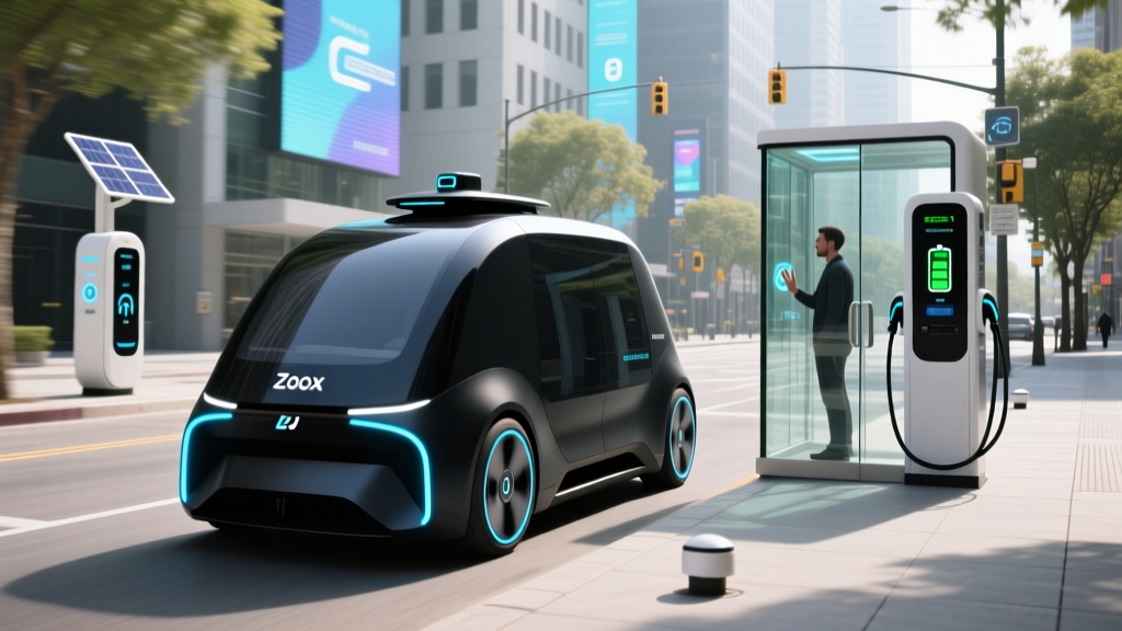
| Zoox | Purpose-built bidirectional carriage (no steering wheel) | Las Vegas (Strip corridor + Downtown), Foster City/San Francisco (limited pilot zones) | Daytime and evening; not 24/7 | Dense urban cores; airport service in LAS |
| Cruise (post-restructure) | Chevrolet Bolt EV / next-gen Origin (paused) | Phoenix (limited supervised re-launch), Dallas (testing phase, invite-only) | Daytime only; safety driver present in most vehicles | Smaller geofence than pre-2023 operations |
Not yet on the map: Announced expansions to cities like Miami, Atlanta, and Tokyo remain in testing or regulatory-review phases. If a city does not appear above, you cannot currently book a paid, fully driverless ride there — regardless of press-release timelines.
How to Ride: Apps, Wait Times, and the Passenger Experience
Booking a robotaxi mirrors conventional rideshare. Download the Waymo One or Zoox app, enter your pickup and dropoff (both must fall within the geofence), confirm the fare upfront, and walk to the designated pickup pin. The vehicle arrives, you unlock it via the app, buckle up, and the ride begins with no human behind the wheel.
Typical wait times in core service zones range from 3 to 8 minutes during peak hours — comparable to UberX in the same neighborhoods. Waymo's fleet size in Phoenix and San Francisco (several hundred vehicles each) keeps availability high. Zoox's smaller Las Vegas fleet can mean 10–15 minute waits during Strip peak times.
What It Feels Like
Rides are deliberate and conservative. Expect the vehicle to pause an extra second at four-way stops, yield broadly to pedestrians, and maintain posted speed limits precisely. There is no aggressive lane-weaving. In-cabin screens show the vehicle's perception of surrounding objects in real time — a useful trust-builder for first-time riders.
Robotaxi Pricing vs. Uber and Lyft: What You Actually Pay
Robotaxi fares are not universally cheaper than rideshare. Operators are still subsidizing rides to build market share, but the gap has narrowed since 2023's deep-discount era.
| Service | Typical Fare | Surge Pricing | Tipping |
|---|---|---|---|
| Waymo One | $11–$16 | Mild demand pricing; less volatile than rideshare | Not expected (no driver) |
| Zoox (Las Vegas) | $9–$14 | Limited surge; flat-rate common on Strip routes | Not expected |
| UberX | $12–$20 | Frequent surge; 1.5x–2.5x during peak | $2–$5 typical |
| Lyft Standard | $12–$19 | Prime Time pricing applies | $2–$5 typical |
On a per-mile basis, Waymo in Phoenix averages roughly $2.00–$2.80/mile after the initial base fare, landing near UberX on non-surged days. The advantage widens during high-demand windows when Uber/Lyft surge but robotaxi pricing stays relatively flat. The disadvantage: you cannot hail a robotaxi outside its geofence, so a trip from Scottsdale to a far suburb may simply not be available.
Safety by the Numbers: What the Data Actually Shows
According to California DMV disengagement reports and operator-published safety data through 2025:
- Waymo has accumulated over 40 million fully driverless miles across Phoenix, San Francisco, and Los Angeles. Their published collision rate for property-damage-only incidents is approximately 40% lower than human benchmarks in comparable urban environments, per Waymo's safety reports.
- Zoox has logged roughly 1 million driverless passenger miles in Las Vegas and California pilot zones, with no reported at-fault serious-injury collisions as of early 2026.
- Cruise's pre-suspension record in San Francisco (2022–2023) showed a higher rate of contact incidents per million miles than Waymo, contributing to the California DMV's October 2023 permit suspension. The restructured Cruise operation now runs with safety drivers in most vehicles.
For reference, the NHTSA FARS database records approximately 1.33 fatalities per 100 million vehicle miles traveled across all U.S. roads. Robotaxi fleets have not accumulated enough miles to draw statistically definitive fatality-rate comparisons, but the available data suggests they are at least comparable to — and likely safer than — human drivers in equivalent low-speed urban settings.
Incidents That Shaped the Map
The October 2023 Cruise incident in San Francisco — where a pedestrian was dragged after being struck by a human-driven vehicle and then run over by a Cruise robotaxi — led to a statewide permit revocation and a nationwide operational pause. That event compressed Cruise's robotaxi map from six cities to essentially zero, and the recovery has been slow and supervised. It also prompted the NHTSA to issue updated Standing General Orders requiring more granular collision reporting from all ADS-equipped vehicle operators.
Under the Hood: The Technology Stack Powering Each Fleet
Not all robotaxis perceive the world the same way. The sensor and compute architectures differ substantially between operators — and those differences affect where each one can safely operate.
| Operator | Primary Sensors | Camera Role | HD Mapping | Compute |
|---|---|---|---|---|
| Waymo (5th-gen Driver) | Custom LiDAR (360°), imaging radar, audio detection | 8+ cameras for classification, traffic-light reading, redundancy | Centimeter-precision HD maps; continuously updated | Custom TPU-based onboard compute |
| Zoox | Redundant LiDAR, radar, 360° camera array | Primary perception + classification in bidirectional sensor pods | HD maps with real-time localization | Custom NVIDIA-based compute stack |
| Cruise (current) | LiDAR + radar + camera suite (Bolt EV platform) | Object classification, lane detection | HD maps; geofence-restricted | Modified GM/Cruise compute platform |
LiDAR vs. Camera-Only: Why It Matters for the Map
Every current Level 4 robotaxi uses LiDAR as a primary sensor. This stands in contrast to Tesla's camera-only approach for its Level 2 FSD (Supervised) system. LiDAR provides precise 3D distance measurements independent of lighting conditions, which is why robotaxis can operate at night and in low-sun glare scenarios where camera-only systems struggle. The tradeoff is cost: a single automotive-grade LiDAR unit can add $1,000–$3,000+ to vehicle hardware, which partly explains why robotaxi fleets require significant capital investment per vehicle.
HD mapping is equally critical. Every robotaxi on the map above operates within a pre-mapped zone. The vehicle's software knows the exact position of every curb, lane marking, and traffic signal before it arrives. When construction alters a road or the map becomes stale, the vehicle will either reroute or safely stop and request remote guidance — it will not improvise in unmapped territory.
Who Approves the Robotaxi Map: The Regulatory Landscape
Deploying a driverless taxi in the U.S. requires navigating a patchwork of state and federal approvals — there is no single national robotaxi license.
- California (CPUC + DMV): The California DMV issues testing and deployment permits for autonomous vehicles. The California Public Utilities Commission (CPUC) separately regulates commercial passenger service. Operators need both. After the Cruise suspension, the CPUC tightened reporting requirements and now reviews expansion requests on a zone-by-zone basis.
- Arizona: The most permissive major market. No state-level autonomous vehicle permit is required beyond standard business licensing and insurance. This is why Phoenix was Waymo's first commercial launch city and remains its most expansive service area.
- Nevada: Requires an Autonomous Vehicle License from the DMV plus a certificate from the Nevada Transportation Authority for commercial passenger service. Zoox operates under these provisions in Las Vegas.
- Texas: Autonomous vehicles must register with TxDOT and carry minimum insurance. Austin's robotaxi presence is growing, with Waymo now serving core corridors.
- Federal (NHTSA): The National Highway Traffic Safety Administration does not "approve" robotaxi services, but it sets Federal Motor Vehicle Safety Standards (FMVSS) and investigates collisions. NHTSA's Standing General Order requires all entities operating ADS-equipped vehicles to report crashes within 24 hours.
The practical result: a robotaxi map is as much a regulatory map as a technological one. Phoenix and Austin expanded faster because their states required less paperwork. San Francisco and Los Angeles — despite massive demand — expanded slowly because California's dual-agency approval process is deliberately cautious post-Cruise.
Current Limitations: Where the Robotaxi Map Ends
- Weather restrictions: Heavy rain, fog, and snow degrade LiDAR and camera performance. Waymo suspends service during monsoon-level Phoenix storms and heavy San Francisco fog events. None of the current robotaxi cities experience sustained winter snow — that is not a coincidence.
- Geofence boundaries: If your destination falls outside the mapped zone, the app will not let you book. You cannot override this. Service areas expand incrementally, but suburbs, rural roads, and highways outside approved corridors remain inaccessible.
- Construction and detours: When a mapped road is closed for construction, the vehicle may stop and wait for remote-assist guidance rather than navigate an unmapped detour. This can add 5–15 minutes to a trip.
- Complex pickups: Gated communities, parking garages, private driveways, and hotel porticos with complex traffic flow are often unsupported. You will be directed to the nearest public curb.
- No intercity travel: You cannot take a robotaxi from San Francisco to Sacramento or Phoenix to Tucson. These are strictly intra-metro services.
- Accessibility gaps: Waymo's Jaguar I-PACE requires passengers to enter a standard SUV cabin. Zoox's purpose-built carriage offers level-floor entry but is only available in limited zones. Wheelchair-accessible robotaxi options remain scarce.
Frequently Asked Questions
Where can I use a robotaxi service right now?
Fully driverless, paid robotaxi rides are available in Phoenix, San Francisco, Los Angeles, Austin (Waymo), and Las Vegas (Zoox). Cruise operates limited supervised service in Phoenix and Dallas. No other U.S. city has a live, bookable Level 4 robotaxi as of mid-2026.
How much does a robotaxi cost compared to Uber or Lyft?
Expect to pay $11–$16 for a typical 5-mile urban ride on Waymo, which is comparable to UberX on non-surged days and often cheaper during peak-demand windows. Zoox in Las Vegas tends to be slightly cheaper at $9–$14 for common Strip routes. Neither robotaxi service applies aggressive surge pricing.
How safe are robotaxis — is there real data?
Waymo has logged over 40 million fully driverless miles with a property-damage collision rate approximately 40% lower than human benchmarks in comparable urban settings, per their published safety data. No robotaxi fleet has accumulated enough miles for statistically definitive fatality-rate comparisons against the national average of 1.33 per 100 million miles (NHTSA FARS). The available evidence points to safety at or above human-driver levels in low-speed urban environments.
What are the current limitations of robotaxi service?
Major limitations include: geofence restrictions (you cannot book outside the mapped zone), weather suspensions during heavy rain or fog, inability to navigate unmapped construction detours without remote assistance, no intercity travel, limited pickup options at gated or private locations, and sparse wheelchair-accessible vehicle availability.
Is this truly self-driving or is it driver-assist like Tesla Autopilot?
Commercial robotaxis from Waymo and Zoox are SAE Level 4 — fully driverless within their approved zones, with no human in the vehicle. This is fundamentally different from Tesla's FSD (Supervised), GM's Super Cruise, and Ford's BlueCruise, which are all SAE Level 2 systems requiring the human driver to remain engaged and ready to take over at all times. You cannot summon a Tesla as a driverless taxi.
Will the robotaxi map expand to my city soon?
Waymo has announced testing or early deployment plans for additional cities, but regulatory approval timelines vary significantly by state. Arizona and Texas tend to approve faster; California, despite being the technology's birthplace, has adopted a more cautious post-Cruise approval cadence. If your city is not listed in the availability table above, expect at least 12–24 months before potential service — and likely longer if your state lacks autonomous vehicle legislation.