The Short Answer: Highway Access Depends on the City
If you've ridden in a Waymo One robotaxi through downtown Phoenix or San Francisco, you may have wondered: do Waymos go on the highway? The answer isn't a simple yes or no. As of early 2026, Waymo's sixth-generation Jaguar I-PACE fleet can navigate select highway segments, but only within strictly geofenced corridors in approved metro areas. Highway operation is not universal across all Waymo One markets, and it is never available on long-distance intercity routes.
This distinction matters because consumer expectations around "self-driving" often blur the line between a geofenced robotaxi (SAE Level 4) and a driver-assist feature like Tesla's FSD Supervised (SAE Level 2). Below, we break down exactly where Waymo operates, how highway driving fits into the service, what the safety data shows, and what limitations remain.
Waymo One operates at SAE Level 4 (High Automation). This means the vehicle handles all driving tasks — steering, braking, navigation, lane changes — within a defined operational design domain (ODD) without any human driver present. There is no steering wheel interaction or pedal input from a passenger. This is fundamentally different from SAE Level 2 systems (Tesla Autopilot, GM Super Cruise, Ford BlueCruise), which require continuous driver supervision and hands-on or eyes-on engagement. Waymo is not "driver-assist." It is a driverless commercial service.
Where Can You Use Waymo One Right Now?
Waymo One's commercial ride-hailing service has expanded steadily since its Phoenix debut, but availability remains metro-specific and geofence-bound. Here is the current operational map as of Q1 2026:
| Metro Area | Service Status | Approx. Geofence Area | Highway Segments Included? |
|---|---|---|---|
| Phoenix, AZ (East Valley) | Fully operational 24/7 | ~315 sq mi | Yes — select freeway on/off-ramps and short freeway segments (e.g., portions of Loop 101, Loop 202) |
| San Francisco, CA | Fully operational 24/7 | ~55 sq mi (most of city) | Limited — some highway-adjacent arterials; full freeway segments under phased expansion |
| Los Angeles, CA | Operational (phased rollout) | ~80 sq mi (Santa Monica, Hollywood, downtown core) | Limited — surface streets primarily; freeway access in testing phase |
| Austin, TX | Operational (early phase) | ~45 sq mi (downtown, South Austin) | Not yet — surface streets only in current geofence |
Source: Waymo One service area page. Note that geofence boundaries shift as Waymo receives regulatory approval for expansion zones. A neighborhood that was outside the service area six months ago may be included today.
How Waymo Handles Highway Driving
When a Waymo trip includes a geofenced highway segment, the vehicle performs the same maneuvers a human driver would: merging via on-ramp, matching traffic speed (up to posted limits, typically 65 mph in approved corridors), executing lane changes, and navigating off-ramps. Waymo's sixth-generation "Driver" hardware suite is specifically designed for this complexity.
However, there are hard constraints:
- No intercity highway trips. You cannot hail a Waymo from Phoenix to Tucson or from San Francisco to Sacramento. The geofence boundary is a hard wall — the vehicle will not plan a route that exits its approved ODD.
- Highway segments are pre-mapped and pre-approved. Waymo doesn't dynamically decide to take any highway. Each freeway segment must be HD-mapped, validated in simulation, and cleared by Waymo's safety team before it enters the live geofence.
- Weather restrictions apply. Heavy rain, fog, or dust storms in Phoenix can trigger a service suspension on highway segments even when surface-street rides continue.
Technology Stack: How the Waymo Driver "Sees" the Road
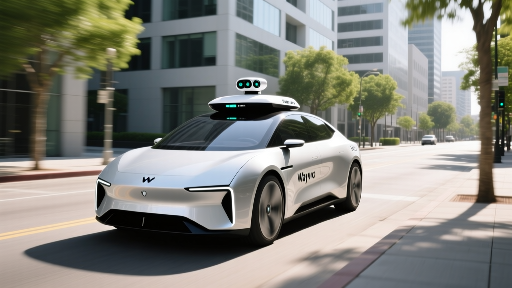
Unlike Tesla's camera-only approach, Waymo relies on a multi-sensor fusion stack. The sixth-generation Waymo Driver (deployed on the Jaguar I-PACE fleet) includes:
- LiDAR: Multiple high-resolution LiDAR units providing a 360° 3D point cloud, effective at 500+ meters. LiDAR gives Waymo precise depth perception independent of lighting conditions — critical for highway merge detection and high-speed obstacle classification.
- Cameras: A surround-camera array (high dynamic range) for traffic-light state detection, signage recognition, lane-marking identification, and color classification of brake lights and turn signals.
- Radar: Imaging radar units for velocity measurement of surrounding objects and performance in rain or fog where LiDAR and cameras degrade.
- External audio sensors: Microphones that detect sirens from emergency vehicles, triggering pull-over behavior.
- HD maps + localization: Centimeter-precision maps of every geofenced road, updated continuously. The vehicle localizes itself within these maps using LiDAR and IMU data — it doesn't "see the road for the first time" the way a human does.
This sensor redundancy is a key reason regulators have approved Waymo for driverless commercial service. If one sensor modality is degraded (e.g., camera glare at sunset), LiDAR and radar maintain object tracking. Tesla's FSD, by contrast, relies exclusively on cameras — a design choice that has drawn scrutiny from NHTSA in multiple crash investigations.
Pricing: Waymo One vs. Uber and Lyft
Waymo One pricing is designed to be competitive with conventional rideshare, not premium. Fares are calculated using a combination of distance, time, and demand — similar to Uber/Lyft algorithms — but without a human driver's earnings factored into the cost structure.
| Service | Estimated Fare | Surge Pricing? | Wait Time (Typical) |
|---|---|---|---|
| Waymo One | $12 – $18 | Minimal — fleet-managed pricing | 3–8 min (varies by fleet density) |
| UberX | $11 – $20 | Yes — can 1.5x–3x during peak | 2–6 min |
| Lyft Standard | $10 – $19 | Yes — Prime Time pricing | 3–7 min |
On a per-mile basis, Waymo fares typically land between $1.80 and $3.00/mile depending on the metro and time of day. The key advantage for Waymo isn't always price — it's consistency. Because there is no driver to rate, tip, or worry about, and because surge pricing is fleet-managed rather than market-driven, riders report more predictable fares. Waymo also accepts standard payment methods through the Waymo One app, and tipping is not required (there is no driver).
Safety Record: What the Data Actually Shows
Waymo has accumulated over 40 million fully driverless miles across its commercial and testing operations as of late 2025, with that number continuing to climb through 2026. The company publishes safety performance data, and independent analyses have been conducted by organizations including the Insurance Institute for Highway Safety (IIHS) and various university transportation research groups.
- Total driverless miles: 40+ million (cumulative through 2025; 2026 figures ongoing)
- Injury-causing crash rate: ~85% lower than human benchmarks in comparable urban geofences, per Waymo's published analysis using NHTSA crash-rate baselines
- Police-reported crash rate: ~57% lower than human benchmarks in the same operating areas
- Most common incident type: Low-speed contact with stationary objects or other vehicles during complex urban maneuvers (not highway-speed collisions)
- Remote assistance: Waymo vehicles can request remote guidance from a human operations specialist. This is not remote "driving" — the specialist provides high-level routing advice (e.g., "the construction zone is passable on the left"), while the vehicle's autonomous system continues to execute all steering and braking.
It's important to contextualize these numbers. Waymo's geofenced urban routes involve lower average speeds and mapped environments, which are inherently less chaotic than unrestricted driving. The comparison benchmarks also matter: Waymo compares its crash rates to human drivers in the same cities and road types, not to national averages that include rural highways. No robotaxi fleet has operated long enough at scale to produce multi-decade actuarial data, so these figures represent early but encouraging signals — not a guarantee.
Regulatory Landscape: Who Approves Robotaxi Operations?
Robotaxi deployment in the United States is governed by a patchwork of state and local regulations — there is no single federal "robotaxi license." Here's how the approval chain works:
- State level: Each state sets its own rules for autonomous vehicle testing and commercial deployment. In Arizona, the regulatory environment is permissive — the state has allowed driverless commercial operations since 2018 with minimal permitting friction. California, by contrast, requires approval from both the California Department of Motor Vehicles (DMV) (for testing and deployment permits) and the California Public Utilities Commission (CPUC) (for commercial ride-hailing authorization). The CPUC suspended Cruise's commercial permit in late 2023 following safety incidents, illustrating how quickly regulatory approval can be revoked.
- Federal level: NHTSA retains authority over vehicle safety standards and crash investigations but does not currently issue operational permits for robotaxis. Federal legislation creating a unified autonomous vehicle framework has stalled in Congress repeatedly.
- Local/municipal: Cities can impose additional restrictions — speed limits on autonomous vehicles, school-zone operating rules, and coordination requirements with local emergency services.
Waymo's expansion into each new metro requires navigating this multi-layered approval process, which is why growth is measured in years, not months.
Current Limitations: What Waymo Cannot Do
Understanding the boundaries of Waymo's service is as important as understanding its capabilities. Here are the hard limitations as of 2026:
- No long-distance or intercity trips. The geofence is absolute. You cannot use Waymo as a highway cruiser between cities.
- Severe weather suspensions. Heavy rain, dense fog, snow, or dust storms can trigger automatic service pauses. Waymo does not currently operate in snow-affected metros.
- Construction zone complexity. While Waymo handles routine construction zones, major road reconfigurations with conflicting lane markings or temporary barriers may cause the vehicle to pull over and request remote assistance, adding minutes to your trip.
- No rural or unmapped roads. If a road isn't in Waymo's HD map database and validated ODD, the vehicle won't drive on it.
- Pickup/dropoff precision. The vehicle stops at safe, legal curbside locations — it won't pull into a private driveway, parking garage, or gated community. You walk to the curb.
- Accessibility constraints. The Jaguar I-PACE fleet is an SUV platform. Wheelchair-accessible vehicle options remain limited, though Waymo has announced plans to integrate accessible vehicles in future fleet expansions.
- No food or item delivery (via Waymo One). Waymo One is a passenger service. Waymo has separate delivery partnerships (e.g., with Uber Eats in select markets), but those use a different service flow.
Is This Truly Self-Driving — or Just Advanced Driver-Assist?
This is where consumer confusion runs deepest, and the distinction is non-negotiable:
Waymo One is SAE Level 4. There is no human driver in the vehicle. No one is sitting behind the wheel ready to take over. You sit in the back seat (or the front passenger seat, if you prefer), and the car handles everything within its geofence. You cannot "take over" because there are no driver controls accessible to passengers. If the system encounters a scenario it cannot handle, it performs a minimal-risk maneuver — typically pulling to the curb and stopping — and may contact a remote operations specialist for guidance.
Tesla FSD (Supervised), GM Super Cruise, Ford BlueCruise, and similar consumer features are SAE Level 2. The human driver is always responsible. The system assists with steering and speed, but the driver must monitor the road at all times and be ready to intervene instantly. Calling these systems "self-driving" is technically incorrect and, more importantly, dangerous — NHTSA crash data shows that misuse of Level 2 systems (e.g., inattentive driving while Autopilot is engaged) has contributed to numerous serious crashes.
Waymo is the closest thing to a genuine "self-driving taxi" available to consumers today. Zoox (Amazon's autonomous vehicle subsidiary) operates a similar Level 4 service in limited areas of Las Vegas and Foster City, CA, but with a smaller fleet and narrower availability.
Frequently Asked Questions
Can I take a Waymo on the freeway from Phoenix to Scottsdale?
Partially. Waymo's Phoenix geofence includes portions of the Loop 101 and Loop 202 freeways, so trips that use these segments within the geofence boundary are supported. However, if your origin or destination falls outside the geofence, the app will not offer a route. Check the Waymo One app's service map before planning a trip.
How much does a Waymo ride cost compared to Uber?
For a typical 5-mile urban trip, Waymo One fares range from $12 to $18, which is comparable to UberX ($11–$20) before surge pricing. Waymo's advantage is fare predictability — surge multipliers are minimal because the fleet is centrally managed rather than subject to individual driver supply-and-demand dynamics.
Has a Waymo ever been in a serious crash?
Waymo vehicles have been involved in police-reported incidents, as any fleet operating millions of miles in urban traffic will be. The majority are low-speed contacts (e.g., a vehicle backing into the Waymo at a stop, or minor scraping during tight construction-zone navigation). According to Waymo's published data analyzed against NHTSA benchmarks, the injury-causing crash rate is approximately 85% lower than comparable human drivers. No robotaxi fleet has zero incidents — the question is the rate relative to human-driven vehicles in the same environments.
Does Waymo operate at night?
Yes. In Phoenix and San Francisco, Waymo One operates 24/7. The LiDAR and radar sensor suite does not rely on visible light, so nighttime operation does not degrade perception the way it might for a camera-only system. In Los Angeles and Austin, hours may be more limited during early rollout phases.
Can I use Waymo at the airport?
In Phoenix, Waymo One service extends to Phoenix Sky Harbor International Airport (PHX), including the terminal curbside pickup area. In San Francisco, SFO access has been part of the service expansion. Check the in-app map for exact airport pickup zones, as they are designated areas rather than arbitrary curbside stops.
What happens if the Waymo encounters something it can't handle?
The vehicle executes a minimal-risk maneuver — typically slowing down and pulling to the nearest safe curb. It may then connect to a remote operations specialist who provides contextual guidance (not direct driving control). If the situation cannot be resolved, Waymo dispatches roadside assistance or offers to reroute. You are never stranded without recourse, but the trip may take longer than expected.