The robotaxi industry has matured past the hype cycle and into the hard engineering phase — and the companies winning paid rider contracts in 2026 share one common thread: sensor suites built by a small but fiercely competitive group of autonomous driving sensor providers. Whether you're tracking which vehicles operate without a human behind the wheel, evaluating the safety record of driverless fleets, or simply trying to understand what hardware actually makes Level 4 autonomy possible, the answer always leads back to the sensors.
This guide maps the major sensor providers powering commercial robotaxi services today, breaks down the technology stacks they enable, and grounds every claim in operational data — cities served, miles driven, intervention rates, and real pricing versus Uber and Lyft.
SAE Automation Levels: Where Robotaxis Actually Sit
Before dissecting sensor hardware, the autonomy level must be precise. Consumer vehicles with Tesla Autopilot, Ford BlueCruise, or GM Super Cruise are SAE Level 2 — the driver must remain engaged at all times. Robotaxis from Waymo and Zoox operate at SAE Level 4 — fully driverless within a defined operational design domain (ODD), meaning specific geofenced areas under mapped conditions.
| SAE Level | Definition | Example | Driver Required? |
|---|---|---|---|
| Level 2 | Partial automation — steering + acceleration assisted | Tesla FSD (Supervised), BlueCruise, Super Cruise | Yes, always |
| Level 3 | Conditional automation — system drives in limited scenarios, driver on standby | Mercedes DRIVE PILOT (limited markets) | Standby |
| Level 4 | High automation — fully driverless within geofenced ODD | Waymo One, Zoox (SF/Las Vegas) | No (within ODD) |
| Level 5 | Full automation — any road, any condition | Does not exist commercially | No |
No commercially available system in 2026 is Level 5. Every robotaxi service operates under geofencing, weather restrictions, and mapped-route constraints. The sensor providers below build the hardware that makes Level 4 viable within those limits.
The Major Autonomous Driving Sensor Providers in 2026
The robotaxi sensor supply chain has consolidated around a handful of companies that deliver production-grade lidar, imaging radar, and high-resolution camera modules at fleet scale. Here are the providers with the deepest integration into live commercial services.
Waymo (In-House Lidar + Camera + Radar)
Waymo designs and builds its own sensor suite — branded as the 6th-generation Waymo Driver — rather than sourcing from third parties. The current hardware includes custom lidar units with a proprietary scanning architecture, high-resolution cameras covering 360 degrees, and imaging radar modules. This vertical integration gives Waymo tight control over sensor fusion but means the company is both the operator and the sensor provider. The 6th-gen system improved near-field resolution (critical for detecting cyclists and pedestrians at close range) and extended reliable detection range beyond 500 meters for high-speed scenarios.
Mobileye (Intel Subsidiary)
Mobileye supplies camera-based perception systems and EyeQ system-on-chip processors to multiple OEMs and autonomous development programs. Their SuperVision and Chauffeur platforms use 11+ cameras with no lidar dependency for Level 2+ and Level 3 applications. For Level 4 robotaxi ambitions, Mobileye has partnered with fleet operators in Europe and Israel, using a camera-first approach supplemented by radar. Their REM (Road Experience Management) mapping system crowdsources high-definition maps from consumer vehicles — a significant cost advantage over lidar-dependent mapping.
Luminar Technologies
Luminar produces long-range automotive lidar (the Iris and next-gen Halo platform) operating at 1550 nm wavelength, which allows higher power output and longer detection range (250+ meters at 10% reflectivity) compared to 905 nm competitors. Luminar has supply agreements with Volvo, Polestar, and Mercedes-Benz for production consumer vehicles, and their lidar is used in several Level 4 development and pilot programs. Their strength is highway-speed object detection — identifying debris, stopped vehicles, and lane intrusions at distances that give the planning system adequate reaction time.
Ouster (Digital Lidar)
Following the Ouster-Quanergy merger and subsequent pivots, Ouster supplies digital lidar sensors used in autonomous shuttles, logistics robots, and some Level 4 pilot programs. Their solid-state architecture and high-resolution point clouds make them a preferred supplier for applications where cost-per-unit and reliability in vibration-heavy environments matter. They're less visible in consumer-facing robotaxis but deeply embedded in the autonomous logistics and shuttle segment.
Hesai Technology
Chinese lidar manufacturer Hesai supplies sensors to a wide range of autonomous driving programs globally, including robotaxi operators in China (Baidu Apollo, Pony.ai, AutoX) and several Western development programs. Their AT128 and FT120 solid-state units offer high point-cloud density at competitive pricing. Hesai faces ongoing US trade scrutiny, which has complicated adoption by American robotaxi operators, but their global footprint in Level 4 testing remains substantial.
Continental & Bosch (Tier 1 Radar + Sensor Fusion)
Both Continental and Bosch supply imaging radar, ultrasonic sensors, and sensor fusion middleware to OEMs building Level 2+ through Level 4 systems. Continental's ARS640 imaging radar provides 4D detection (range, velocity, azimuth, elevation) and is integrated into several robotaxi development platforms. Bosch's long-range radar and mid-range radar units are ubiquitous across the industry — even operators using lidar-dominant stacks typically rely on Bosch or Continental radar as a redundant perception layer.
Technology Stack Breakdown: Lidar vs. Camera-Only vs. Sensor Fusion
| Approach | Primary Sensors | Strengths | Weaknesses | Notable Users |
|---|---|---|---|---|
| Lidar-Dominant Fusion | Lidar + cameras + radar | Precise 3D mapping, reliable in varied lighting, redundant depth data | Higher hardware cost, aesthetic integration challenges | Waymo, Zoox, Cruise (legacy), Baidu Apollo |
| Camera-First / Vision-Only | Multi-camera array + neural networks | Lower hardware cost, scalable via software, leverages visual data richness | Struggles in low light, fog, heavy rain; no native depth measurement | Tesla (FSD Supervised — Level 2), Mobileye pilots |
| Imaging Radar Fusion | 4D radar + cameras + limited/no lidar | Works in all weather, lower cost than lidar, good velocity detection | Lower spatial resolution than lidar, coarser object classification | Emerging L3/L4 programs, Continental demos |
The industry consensus in 2026 is that Level 4 robotaxi operations require lidar as part of the sensor stack. Camera-only approaches have proven effective for Level 2 driver-assist at scale (Tesla's FSD Supervised has accumulated billions of miles), but no camera-only system has achieved regulatory approval for driverless commercial service. The redundancy that lidar provides — direct, active measurement of distance independent of ambient light — remains a requirement for the safety case that regulators demand before approving driverless operations.
Where Can You Actually Use a Robotaxi Right Now?
Commercial, paid, fully driverless robotaxi service in the United States remains concentrated in a handful of cities. Here is the current operational map as of 2026:
| Service | Operator | Cities (Paid Driverless) | Hours | Geofence Notes |
|---|---|---|---|---|
| Waymo One | Waymo (Alphabet) | Phoenix metro (Chandler, Tempe, Mesa, Scottsdale, parts of Phoenix), San Francisco, Los Angeles (expanding) | 24/7 in Phoenix; 24/7 in SF | Geofenced to mapped areas; ~200+ sq mi in Phoenix; SF covers most of the city |
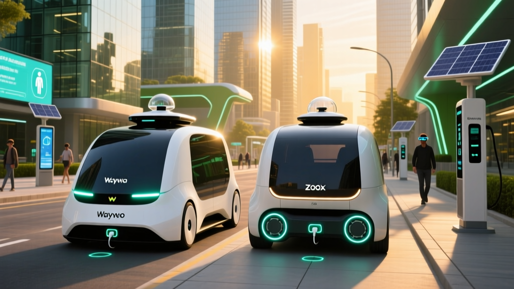
| Zoox | Zoox (Amazon) | Las Vegas (limited corridor), San Francisco (pilot/paid rides expanding) | Limited hours | Purpose-built vehicle; constrained routes initially |
| Baidu Apollo Go | Baidu | Wuhan, Beijing, Chongqing, Shenzhen (China) | Varies by city | Largest fleet globally; 1000+ vehicles in Wuhan alone |
| Pony.ai | Pony.ai | Beijing, Guangzhou, Shenzhen (China); limited US testing | Varies | Operates in designated zones with regulatory approval |
Important context: Cruise (GM) suspended all driverless operations in late 2023 following a serious incident in San Francisco and has been gradually re-entering markets with human safety operators as of 2025-2026. Full driverless commercial service from Cruise has not resumed at the scale of Waymo.
Safety Record: What the Data Actually Shows
Waymo safety data (as reported and studied through 2025-2026):
- 30+ million fully driverless miles completed across Phoenix, San Francisco, and Los Angeles (cumulative through early 2026)
- Fatalities: Zero confirmed fatalities in driverless (no safety driver) operation as of early 2026
- Contact rate: Waymo's published analysis (peer-reviewed through insurance claim data and internal reporting) shows a ~85% reduction in injury-causing crash involvement per million miles compared to the human-driven baseline in the same geographies
- Property-damage-only contacts: Higher than injury crashes but still below human baselines; most involve low-speed scenarios (stationary object contact, minor rear-end situations when the Waymo vehicle stops conservatively)
- Intervention / disengagement: In driverless mode, there is no human to "disengage" — instead, Waymo tracks "remote assistance" events where a human specialist provides guidance. Rate: approximately 0.5-1.5 remote assists per 1,000 miles depending on city complexity (lower in Phoenix, higher in SF)
Sources: NHTSA Standing General Orders for ADS incident reporting; Waymo published safety analyses; IIHS research reviews.
For context, the US human-driven fatality rate is approximately 1.35 deaths per 100 million vehicle miles traveled (NHTSA, recent annual data). Waymo's 30+ million driverless miles with zero fatalities is a promising signal but not yet statistically conclusive — you need hundreds of millions of miles to confidently demonstrate a fatality rate lower than the human baseline. The data is directionally strong but still maturing.
Zoox has accumulated fewer public driverless miles and has not published comparable fleet-wide safety statistics at the same scale. Baidu Apollo Go reports millions of rides in China with no reported fatalities, though independent verification of Chinese ADS safety data remains limited.
Robotaxi Pricing vs. Uber and Lyft
| Service | Typical Fare (5-mile trip) | Surge Pricing? | Tipping | Availability |
|---|---|---|---|---|
| Waymo One (Phoenix) | $8–$15 | Rarely; more predictable than rideshare | In-app option | On-demand, usually 2-6 min wait |
| Waymo One (San Francisco) | $10–$20 | Occasional demand pricing | In-app option | On-demand, 3-10 min wait depending on area |
| UberX (national average) | $10–$18 | Yes, frequent during peak | Expected | On-demand, varies widely |
| Lyft Standard (national average) | $9–$17 | Yes, frequent during peak | Expected | On-demand, varies widely |
| Baidu Apollo Go (Wuhan) | ~$1–$4 USD equivalent | Minimal | Not customary | High availability in zone |
Waymo's pricing is broadly competitive with UberX and Lyft — sometimes slightly cheaper for short trips, sometimes slightly more expensive during off-peak hours when rideshare discounts are aggressive. The key differentiator is predictability: Waymo fares don't surge the way rideshare does during rain, events, or rush hour. Tipping is optional (and the vehicle has no driver to tip, though the app provides the option). For a regular commuter in Phoenix or San Francisco, the total monthly spend is comparable to rideshare, with the added benefit of consistency.
Baidu's pricing in Wuhan is dramatically lower — subsidized heavily to capture market share — which has generated tension with local taxi and rideshare drivers. This pricing model is not sustainable long-term and does not reflect the true cost of robotaxi operations.
Current Limitations: What Robotaxis Cannot Do
- Geofencing: Every Level 4 service is restricted to pre-mapped zones. You cannot summon a Waymo to an unmapped suburb or a rural road. If your destination falls outside the geofence, the ride cannot be completed.
- Weather restrictions: Heavy rain, dense fog, and snow degrade lidar and camera performance. Waymo operates in light rain in Phoenix and San Francisco but will pause or restrict service during severe weather events. Snow-covered roads remain a hard no-go for all current Level 4 systems.
- Construction zones: Major, unmapped construction that alters lane configurations can cause the vehicle to pull over and request remote assistance. Minor, well-marked construction is typically handled, but expect longer routes or conservative behavior.
- Edge cases: Unusual scenarios — a person directing traffic with hand signals, an oversized load, a fallen tree across the road — may trigger a remote-assist event or a safe stop. The vehicle will not improvise.
- No intercity travel: Robotaxis are urban/suburban services. You cannot take a Waymo from Phoenix to Tucson or from San Francisco to Sacramento.
- Limited vehicle types: Current fleets are sedan/SUV form factors. Wheelchair accessibility, large-group seating, and cargo hauling are not yet available in most markets.
- Pickup/dropoff precision: The vehicle stops at a safe, legal curb location — not necessarily the exact front door you specified. In dense urban areas, this can mean a short walk from the dropoff point.
Regulatory Landscape: Who Approves Robotaxi Operations
Robotaxi deployment in the United States requires approval from multiple regulatory bodies, and the framework is state-by-state rather than federally unified:
- California (CPUC + DMV): The California Public Utilities Commission issues permits for commercial passenger service (the "driverless pilot" and "commercial" permits). The DMV issues testing permits and tracks disengagement data. San Francisco operations required both CPUC and DMV approval, plus coordination with the SF Municipal Transportation Agency.
- Arizona: Arizona has maintained one of the most permissive regulatory environments for autonomous vehicles since 2015. No specific state-level permit is required beyond standard vehicle registration and insurance, which enabled Waymo's early Phoenix launch. The Arizona Department of Transportation provides a voluntary testing framework.
- Nevada: Nevada's DMV issues autonomous vehicle testing and deployment permits. Zoox's Las Vegas operations fall under this framework.
- Federal (NHTSA): NHTSA does not currently "approve" ADS for deployment but issues Standing General Orders requiring crash reporting from all ADS operators. NHTSA retains recall and investigation authority and has opened inquiries into Waymo and Cruise incidents. Federal motor vehicle safety standards (FMVSS) still apply to the vehicle platform itself.
- China: Municipal governments (Beijing, Wuhan, Shenzhen, Guangzhou) issue permits for testing and commercial operation. Regulations vary significantly by city, with some allowing fully driverless commercial service and others requiring a remote or in-vehicle safety operator.
The lack of a unified federal framework in the US means expansion to new cities requires navigating a unique regulatory process in each jurisdiction — a significant bottleneck for scaling.
The Sensor Provider Landscape: What's Next
The autonomous driving sensor market is consolidating. Several high-profile lidar startups from the 2020-2022 SPAC boom (Innoviz, Aeva, Cepton) continue to develop but have not achieved the volume or design-win scale of Luminar or Hesai in Level 4 applications. The trend toward 2027-2028 includes:
- Cost reduction: Lidar unit costs have dropped from $50,000+ (early Velodyne units) to under $1,000 for some solid-state designs, with further reductions expected as volume scales.
- 4D imaging radar maturation: Continental, Bosch, and startups like Uhnder and Arbe Robotics are advancing radar resolution to the point where it may reduce (but not eliminate) the number of lidar units needed per vehicle.
- Sensor fusion software: The competitive moat is shifting from hardware alone to the software that fuses lidar, camera, and radar data into a coherent world model. Companies like Applied Intuition and Foretellix provide simulation and validation tools that are becoming as critical as the sensors themselves.
- Solid-state lidar dominance: Mechanical spinning lidar (the iconic rooftop "bucket") is being replaced by solid-state and semi-solid designs that are smaller, cheaper, more reliable, and easier to integrate into production vehicles.
Frequently Asked Questions
Is a robotaxi truly self-driving, or is someone still controlling it?
Waymo One and Zoox vehicles operating in their approved service areas are SAE Level 4 — there is no human driver in the vehicle. A remote operations team monitors the fleet and can provide guidance if the vehicle encounters an unfamiliar situation, but the remote operator does not "drive" the car in real time via joystick. The vehicle makes all driving decisions autonomously within its geofence. This is fundamentally different from Tesla FSD (Supervised), which is Level 2 and requires a human driver to remain attentive.
How much does a Waymo ride cost compared to Uber?
For a typical 5-mile trip, Waymo One fares range from $8 to $20 depending on the city and time of day. This is broadly comparable to UberX ($10–$18) and Lyft Standard ($9–$17). Waymo fares tend to be more predictable — they rarely surge during peak demand the way rideshare does — which can make them cheaper during rush hour or bad weather.
What happens if a robotaxi gets into an accident?
The vehicle is programmed to stop safely, activate hazard lights, and contact remote support. Emergency services are dispatched if needed. All incidents are reported to NHTSA under Standing General Orders. Waymo carries commercial insurance, and the company (not the rider) is liable for incidents caused by the autonomous system. Riders are not required to intervene or take control.
Can I use a robotaxi in any city?
No. As of 2026, paid fully driverless robotaxi service in the US is available in Phoenix (Waymo), San Francisco (Waymo, Zoox expanding), Los Angeles (Waymo expanding), and Las Vegas (Zoox, limited). Expansion to additional cities requires regulatory approval in each jurisdiction, which is a multi-year process. International services operate in several Chinese cities (Wuhan, Beijing, Shenzhen, Chongqing) via Baidu Apollo Go and Pony.ai.
Why do robotaxis still need lidar if cameras and AI are improving?
Cameras capture rich visual data but cannot directly measure distance — they infer depth through neural networks, which can fail in edge cases (unusual objects, extreme lighting, occlusions). Lidar actively emits laser pulses and measures the return time, providing a ground-truth 3D point cloud regardless of lighting conditions. For Level 4 operations where no human is available to intervene, regulators and operators require this redundant, independent depth measurement as part of the safety case. Camera-only systems have not yet achieved regulatory approval for driverless commercial service.
What autonomous driving sensor providers should I watch?
The most consequential providers in 2026 are Waymo (in-house, vertically integrated), Luminar (long-range 1550 nm lidar for OEM and L4 programs), Hesai (dominant in China and globally for testing fleets), Mobileye (camera-first platforms with massive OEM reach), and Continental/Bosch (imaging radar and sensor fusion infrastructure). Emerging players to watch include Ouster (digital lidar for shuttles and logistics), Aeva (FMCW lidar with velocity-per-pixel capability), and Arbe Robotics (high-resolution 4D imaging radar).