How Robotaxis Actually See the World Around Them
Every time a Waymo pulls up to a curb in Phoenix or a Zoox navigates a Las Vegas intersection, a symphony of hardware is processing millions of data points per second. The roof-mounted pods, fender cameras, and grille-embedded radars on these vehicles aren't just accessories — they're the vehicle's entire sensory system. Understanding autonomous car sensors is the key to understanding what robotaxis can do today, where they fall short, and why a Level 4 driverless taxi requires a fundamentally different hardware suite than the Level 2 driver-assist system in your personal EV.
This guide breaks down the sensor stacks powering commercial robotaxi services in 2026, maps where you can actually hail one, examines the safety data behind the headlines, and clarifies the hard line between driver-assist and true driverless operation.
SAE Automation Levels: Where Robotaxis Actually Sit
The most common source of confusion in the autonomous vehicle space is conflating consumer driver-assist with commercial robotaxi capability. The SAE International J3016 framework draws a bright line.
| SAE Level | Name | Who Drives | Examples |
|---|---|---|---|
| Level 0 | No Automation | Human | Basic cruise control |
| Level 1 | Driver Assistance | Human (one axis assisted) | Adaptive cruise OR lane-keeping |
| Level 2 | Partial Automation | Human (must supervise) | Tesla Autopilot/FSD Supervised, GM Super Cruise, Ford BlueCruise |
| Level 3 | Conditional Automation | System (human on standby) | Mercedes Drive Pilot (limited markets, ≤40 mph) |
| Level 4 | High Automation | System (no human needed, geofenced) | Waymo, Zoox, Cruise (where operational) |
| Level 5 | Full Automation | System (everywhere, all conditions) | Does not exist commercially |
The Sensor Stack: Lidar, Cameras, Radar, and Why Most Robotaxis Use All Three
The core debate in autonomous car sensors centers on whether a vehicle needs lidar (light detection and ranging) or can rely on cameras alone. For commercial robotaxi operators carrying paying passengers, the answer has been nearly unanimous: sensor redundancy across multiple modalities is non-negotiable.
Camera Systems
High-resolution cameras (typically 8–12 units per vehicle) provide color, texture, and signage recognition. They're essential for reading traffic lights, detecting brake-light patterns on vehicles ahead, and classifying objects. However, cameras struggle in direct sun glare, heavy rain, fog, and darkness without supplemental lighting. Resolution degrades with distance — a pedestrian at 200 meters may be only a few pixels wide.
Lidar (Light Detection and Ranging)
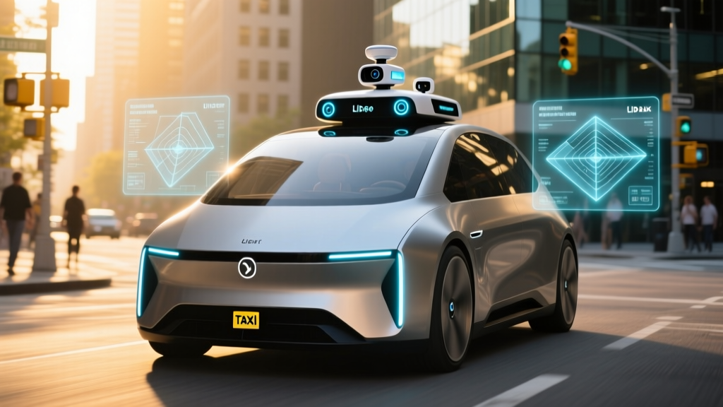
Lidar units emit millions of laser pulses per second and measure their return time to build a precise 3D point cloud of the environment. Modern automotive lidar (from suppliers like Hesai, Waymo's in-house units, and Ouster) achieves centimeter-level resolution at ranges of 200–300 meters. Lidar works independently of ambient light — it performs identically at noon and midnight. Its weakness: heavy precipitation can scatter laser pulses, creating noise.
Radar
Millimeter-wave radar (typically 77 GHz) excels at measuring velocity of moving objects via the Doppler effect and penetrates fog, rain, and dust better than lidar or cameras. Radar range extends to 300+ meters but with much lower spatial resolution. It's the primary sensor for tracking vehicle speeds in the lane ahead.
Ultrasonic Sensors
Short-range ultrasonic transducers (12–16 per vehicle) handle near-field detection below 5 meters — critical for low-speed maneuvering, curb detection during pull-overs, and parking.
IMU, GPS, and HD Maps
Inertial measurement units (IMUs) track vehicle acceleration and rotation at high frequency. RTK-corrected GPS provides positioning to roughly 10–20 cm accuracy. High-definition maps supply lane geometry, speed limits, and traffic-signal locations that the perception system cross-references in real time.
Camera-Only vs. Multi-Sensor: The Industry Split
| Approach | Proponents | Advantages | Trade-offs |
|---|---|---|---|
| Camera-only (vision-based) | Tesla (consumer FSD) | Lower hardware cost, simpler calibration, mimics human vision | No direct depth measurement, degraded in poor lighting/weather, higher reliance on neural-net inference |
| Multi-sensor (lidar + camera + radar) | Waymo, Zoox, Cruise, Aurora, Motional | Redundant depth data, works in darkness, independent failure modes | Higher vehicle cost ($100K–$200K+ per unit historically), more complex calibration, roof-rack aesthetics |
For Level 4 commercial service where no human can intervene, every major robotaxi operator has chosen multi-sensor fusion. The cost premium is justified when the alternative is a single-point-of-failure perception system carrying passengers through uncontrolled urban intersections.
Where Can You Hail a Robotaxi Right Now?
As of early 2026, fully driverless Level 4 robotaxi service is commercially available in a limited but growing number of U.S. metro areas. These aren't pilot programs with safety drivers — these are paid rides with no one behind the wheel.
| Operator | Vehicles | Live Cities (Driverless) | Hours of Operation | Geofence Notes |
|---|---|---|---|---|
| Waymo (Alphabet) | Jaguar I-PACE EV (Gen 5/6 sensor suite) | Phoenix metro, San Francisco, Los Angeles (expanding) | 24/7 in Phoenix; limited hours in SF/LA | Geofenced to approved service areas; ~80+ sq mi in Phoenix |
| Zoox (Amazon) | Zoox purpose-built vehicle (no steering wheel) | Las Vegas (limited area), Foster City, CA (testing) | Limited hours | Tight geofence; invitation/employee-heavy in some zones |
| Cruise (GM) | Chevrolet Bolt EV / Origin (pending) | Operations suspended in most markets after 2023 SF incident; limited restarts in Phoenix, Dallas | Daytime only where active | Heavily restricted; regulatory re-approval required per city |
If you're outside these metros, Level 4 robotaxi service isn't available to you yet. Announced expansions should be treated as planned, not live — regulatory approval, mapping, and fleet deployment typically take 12–18 months after announcement.
How to Use a Robotaxi and What It Costs
Hailing a Waymo in Phoenix or San Francisco works almost identically to Uber or Lyft: open the Waymo One app, enter your destination, confirm pickup, and a vehicle arrives — typically within 3–8 minutes inside the service zone. There's no driver to rate, no tip prompt, and no small talk. The vehicle's interior has a screen showing your route, and you can start or stop the trip via the app or in-vehicle controls.
| Service | Base Fare (typical) | Per-Mile Rate | Per-Minute Rate | Surge Pricing | Tips |
|---|---|---|---|---|---|
| Waymo One | ~$3.00–$5.00 | ~$1.25–$1.75 | ~$0.25–$0.40 | Rare/limited | None |
| Uber (X/Comfort) | ~$2.50–$4.00 | ~$1.10–$1.60 | ~$0.20–$0.35 | Common during peak | Optional (15–20% typical) |
| Lyft | ~$2.50–$4.00 | ~$1.05–$1.55 | ~$0.20–$0.35 | Common during peak | Optional |
For a typical 5-mile urban trip in Phoenix, expect to pay roughly $12–$18 on Waymo — competitive with UberX once you remove the tip. Waymo has historically offered promotional pricing and loyalty credits to build ridership. The real cost advantage of robotaxis emerges at scale: no driver wage means the marginal cost per ride can drop below human-driven rideshare as fleet utilization increases.
Safety Data: What the Numbers Actually Show
Robotaxi safety is the most contested topic in the autonomous vehicle space, and it demands concrete data rather than marketing claims or anecdotal viral videos.
A few critical caveats accompany these numbers:
- Selection bias: Robotaxis operate in geofenced, mapped, and generally well-structured urban areas. They avoid unmapped construction zones, severe weather, and rural roads — conditions that disproportionately cause human crashes.
- Low-speed profile: Robotaxis rarely exceed 45 mph and typically travel at or below posted urban speed limits. High-speed highway crashes are largely absent from their operational domain.
- Contact severity: Most robotaxi-involved incidents are low-speed contact events (being rear-ended at stoplights, sideswiped during lane changes by human drivers). The vehicles' cautious driving style — sometimes criticized as overly conservative — reduces their fault rate but can contribute to rear-end events when human drivers behind them expect more aggressive acceleration.
- Cruise suspension context: Cruise's October 2023 incident in San Francisco — where a pedestrian was struck by a human-driven vehicle and then dragged under a Cruise robotaxi — resulted in California's DMV suspending Cruise's deployment permit. This underscores that Level 4 systems can fail in complex, multi-agent edge cases that are difficult to simulate.
The Insurance Institute for Highway Safety (IIHS) has noted that while early robotaxi data is promising, the sample size remains small relative to the billions of human-driven miles accumulated annually. Drawing definitive conclusions about robotaxi safety equivalence at national scale requires more data across more diverse operating domains.
Current Limitations: Where Robotaxis Cannot Go
Weather
Heavy rain, snow, fog, and ice significantly degrade sensor performance. Lidar scatter increases in precipitation, cameras lose visibility, and road-marking detection fails under snow cover. Most operators suspend or restrict service during severe weather. Waymo in Phoenix benefits from 300+ sunny days per year — this is not coincidental.
Geofencing
Every robotaxi service operates within a pre-mapped, approved boundary. Cross that boundary and the vehicle cannot operate. Expanding a geofence requires HD mapping, regulatory approval, and extensive validation driving — a process measured in months, not days.
Construction Zones and Road Changes
Unplanned construction, temporary lane closures, and recently changed traffic patterns can confuse perception systems. When the HD map disagrees with reality, the vehicle typically executes a minimal-risk maneuver (pull over, contact remote assistance) rather than improvise.
Complex Unprotected Turns
Multi-lane unprotected left turns with oncoming traffic, pedestrians, and cyclists simultaneously present one of the hardest planning challenges. Robotaxis handle these but often with more conservative timing than a human driver would choose.
Pickup/Drop-off Constraints
Robotaxis cannot pull into private driveways, underground parking garages, or unmapped parking lots. Pickups are restricted to mapped, approved curbside locations — which can mean a short walk from your actual destination.
Emergency Vehicle Interaction
While systems detect and yield to emergency vehicles, edge cases remain — particularly when emergency vehicles approach from unexpected directions or when multiple emergency vehicles are present.
The Regulatory Landscape: Who Approves Robotaxi Operations
Robotaxi deployment in the United States requires approval from multiple overlapping authorities, and this regulatory complexity is a primary reason expansion is slow:
- State level: Each state sets its own autonomous vehicle testing and deployment laws. California's DMV issues deployment permits; Arizona has taken a permissive approach with minimal state-level barriers; Texas and Nevada have their own frameworks. The National Conference of State Legislatures tracks AV laws across all 50 states.
- Federal level: NHTSA sets vehicle safety standards (FMVSS) but has not yet issued comprehensive federal AV deployment regulations. The Federal Motor Vehicle Safety Standards were written assuming a human driver — which is why Zoox required an NHTSA exemption for its steering-wheel-free vehicle design.
- Municipal level: City governments, police departments, and fire agencies negotiate operating agreements with robotaxi companies covering pickup zones, emergency protocols, and data sharing.
- CPUC (California): The California Public Utilities Commission regulates commercial passenger service, including robotaxi fare structures and accessibility requirements.
This patchwork means a company approved in Phoenix cannot simply activate service in Austin — each market requires separate regulatory engagement, mapping, and validation.
Autonomous Car Sensors vs. Consumer Driver-Assist: What's Different
If you drive a Tesla with FSD (Supervised), a GM vehicle with Super Cruise, or a Ford with BlueCruise, your car already has an impressive sensor array. But the gap between Level 2 consumer systems and Level 4 robotaxi hardware is substantial:
| Feature | Consumer Level 2 (e.g., Tesla HW4) | Level 4 Robotaxi (e.g., Waymo Gen 6) |
|---|---|---|
| Cameras | 8 cameras, 5 MP typical | 20+ cameras, higher resolution, custom optics |
| Lidar | None (Tesla) / 1 unit (some brands) | Multiple lidar units, 360° coverage, 300m range |
| Radar | 1–5 units (Tesla removed radar in HW4) | Multiple imaging radar units |
| Compute | Onboard SoC (~144 TOPS Tesla HW4) | Custom compute platform, significantly higher throughput |
| Redundancy | Minimal sensor redundancy | Full redundancy: overlapping sensor coverage, backup compute, backup power |
| Cost of sensor suite | $0–$2,000 (embedded in vehicle price) | $30,000–$100,000+ (estimated, declining annually) |
| Driver required | Yes — always | No — fully driverless in geofence |
The cost gap explains why Level 4 hardware isn't coming to your personal car anytime soon. A $50,000+ sensor and compute suite makes economic sense in a fleet vehicle running 18 hours a day generating revenue — it does not make sense in a consumer vehicle parked 95% of the time.
Frequently Asked Questions
Is Tesla FSD the same as a Waymo robotaxi?
No. Tesla FSD (Supervised) is a Level 2 driver-assist system that requires an attentive human driver at all times. The driver bears full legal responsibility. Waymo's service is Level 4 — fully driverless within its geofence, with no human in the driver's seat, and Waymo bears operational liability. They solve fundamentally different problems with fundamentally different sensor and compute architectures.
Where can I ride in a robotaxi today?
Waymo One is available to the public in Phoenix, San Francisco, and Los Angeles (service area varies). Zoox operates limited service in Las Vegas. Cruise is in the process of restarting limited operations in select cities after its 2023 suspension. Outside these metros, Level 4 robotaxi service is not yet commercially available.
How much does a robotaxi ride cost compared to Uber?
Typical Waymo fares are comparable to UberX or Lyft — roughly $12–$18 for a 5-mile urban trip — without surge pricing or tipping. As fleet utilization improves and hardware costs decline, per-mile pricing is expected to decrease below human-driven rideshare rates.
Are robotaxis safer than human drivers?
Early data from Waymo suggests significantly lower injury-crash rates per million miles compared to human benchmarks in similar urban environments (roughly 85% fewer injury-causing crashes). However, robotaxis operate in favorable, geofenced conditions and the total mileage sample remains small relative to national driving data. Definitive large-scale conclusions require more operational data.
Can robotaxis drive in rain or snow?
Light rain is generally manageable. Heavy rain, snow, fog, and ice degrade lidar, camera, and radar performance and typically trigger service restrictions or suspensions. This is why robotaxi services launched first in Phoenix and Las Vegas — dry, sunny climates with minimal weather-related sensor degradation.
What happens if a robotaxi encounters something it can't handle?
The vehicle executes a minimal-risk maneuver — typically slowing down and pulling over to a safe stop. Remote assistance operators can then assess the situation and provide routing guidance. The vehicle will not improvise in scenarios outside its validated capability envelope.
Will autonomous car sensors get cheaper and come to consumer vehicles?
Lidar costs have dropped dramatically — from $75,000+ per unit in 2016 to under $1,000 for some automotive-grade units in 2026. As costs continue declining, expect more consumer vehicles to incorporate lidar-enhanced Level 2+ and Level 3 systems. However, the full redundant sensor suite required for Level 4 operation remains prohibitively expensive for personal vehicles and will likely remain fleet-only for the foreseeable future.